Top Qs
Timeline
Chat
Perspective
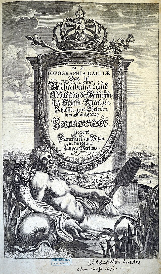
Topographia Galliae
Illustrated book on 17th-century French towns From Wikipedia, the free encyclopedia
Remove ads
Topographia Galliae (1655–1661) is a German-language series of illustrated books created by engraver Matthäus Merian and writer Martin Zeiler, and published in Frankfurt. It describes cities and towns in 17th-century France.[1][2] Wenceslaus Hollar also contributed to its engravings.[3]


Volumes
- Topographia Galliae (in German and Latin) (1st ed.), Frankfurt: Caspar Merian 1655- (13 volumes)[4]
- Topographia Galliae. Vol. 1. 1655 – via Bayerische Staatsbibliothek.; via Google Books
- Contents: Paris, Île-de-France; index
- Die fürnehmste und bekantiste Stätte und Plätze in der Provinc Picardiae. Vol. 2. 1656.
- Topographia Galliae. Vol. 1. 1655 – via Bayerische Staatsbibliothek.; via Google Books
- Topographia Galliae (in German) (2nd ed.). Frankfurt: Caspar Merian. 1655–1661 – via Rhineland-Palatinate Dilibri.
- Die fürnehmste und bekandiste Stätte und Plätze in der Provinc Champagne und Brie. Vol. 3. 1656.
- Die fürnehmste vnd bekantiste Stätte vnd Plätze von Burgund Bresse. Nivernois vnd Dombes. Vol. 4. 1656.
- Die fürnehmste vnd bekantiste Stätte vnd Plätze in den Ländern. Lyonnois. Forests. Beaviolois, vnd Bovrbonnois. Vol. 5. 1657.
- Contents: Lyon
- Die fürnehmste vnd bekantiste Stätte, vndt Plätze in den Ländern. Berry, Avergne. vnd Limosin. Vol. 6. 1657.
- Die fürnehmste vnd bekantiste Stätte vnd Plätze in der Provinc Beavsse, Chartrain. l Angov le Maine. le Perche. Vandosme. le Blaisois. Dvnois. la Tovraine. l'Orleanois. Poictov. l'Avnis. vnd l'Angovmois, Abhandlent. Vol. 7. 1657.
- Die fürnehmste vnd bekantiste Stätte vnd Plätze in dem Hertzogthumb Normandie. Vol. 8. 1657.
- Der Oerter Beschreibung in dem Hochlöblichen Königreich Franckreich/ Der Neundte Theil. Darinn Von dem Hertzogthum Bretaigne, oder dem Kleinern Britannien, in Franckreich gelegen. Vol. 9. 1661.
- Die fürnehmste und bekannteste Städte und Plätze in Guienne, Guascoigne, Saintonge, Bearn, und andern herumbligenden/ als/ Perigord, l'Agenois, &c. Vol. 10. 1661.
- Die fürnehmste und bekanteste Stätte und Plätze in Languedoc, Albigeois, Foix, Giuaudan, Lauraguez, Velay, Vivarez, Quercy, und Roüergue. Vol. 11. 1661.
- Contents: Montpelier, Toulouse, etc.
- Die Provantz, oder la Provence, sambt der anstossenden Graffschafft Venaiscin, Venissy, oder d'Avignon, und das Fürstenthumb von Oranges. Vol. 12. 1661.
- Contents: Avignon, etc.
- Das Land Dauphiné, oder das Delphinat. Vol. 13. 1661.
- Contents: Grenoble, etc.
Remove ads
See also
References
Further reading
External links
Wikiwand - on
Seamless Wikipedia browsing. On steroids.
Remove ads
