Top Qs
Timeline
Chat
Perspective
Tullahan River
River in the National Capital Region, Philippines From Wikipedia, the free encyclopedia
Remove ads
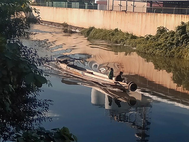
The Tullahan River is a river in the Philippines. It is located to the north of Manila and has an approximate length of 27.1 kilometers (16.8 mi). It starts at the La Mesa Reservoir in Quezon City and flows through Caloocan, Malabon, Valenzuela, and Navotas and empties into Manila Bay.[1] In 2019, San Miguel Corporation pledged ₱1 billion for the cleanup of the Tullahan River as part of the Manila Bay rehabilitation effort.[2]
Remove ads
History
This section needs expansion. You can help by adding to it. (June 2023) |

On June 15, 1995, the Metropolitan Manila Development Authority (MMDA) finished their clean-up of the Tullahan River.[3]
Bridges
Navotas
Malabon
- C-4 Bridge I
- Malabon Bridge
- Lambingan Bridge
- Tinajeros Bridge
- Harbor Link Bridge - includes the rail bridge of PNR
Valenzuela-Malabon
- Tullahan Bridge (MacArthur Highway)
- White Lily Bridge
Valenzuela-Caloocan (South)
- Tullahan Bridge (North Luzon Expressway)
- Ugong Bridge
- Doña Candida Bridge
Valenzuela-Quezon City
- Maceda Bridge
- Tullahan Bridge 3 (Mindanao Avenue)
Quezon City
- Katipunan Bridge
- San Dionisio Bridge
- Gozum Bridge
- Tullahan I Bridge (Quirino Highway)
- Forest Hill Bridge
- Bagong Tulay Bridge
- Accountant Street Bridge
- Tullahan II Bridge (Commonwealth Avenue)
- Capri Bridge (in construction)
Remove ads
See also
References
External links
Wikiwand - on
Seamless Wikipedia browsing. On steroids.
Remove ads


