File:Colonisation_1550.png
From Wikipedia, the free encyclopedia
Oarspronklik bestân (3.600 × 1.578 pixels, bestânsgrutte: 1,14 MB, MIME-type: image/png)
Dit bestân komt fan Wikimedia Commons, en kin ek troch oare projekten brûkt wurde. De beskriuwing op syn bestânsside dêre wurdt hjirûnder werjûn.
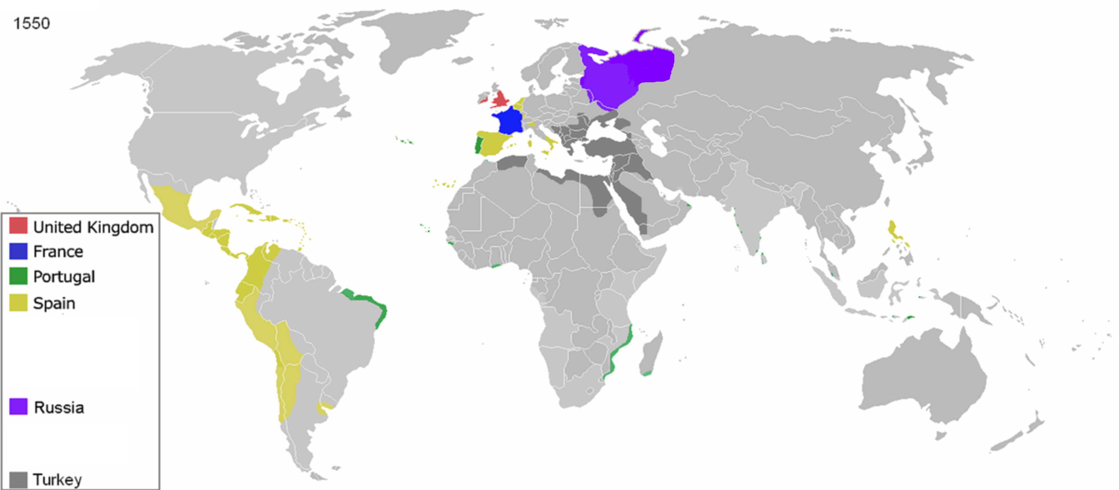
| BeskriuwingColonisation 1550.png |
Map of major world powers by year
As the orriginal licence of the animation was Public Domain, this image which has been derived from it is too:
|
|||||||||||||||||||
| Datum | ||||||||||||||||||||
| Boarne | public domain animated map by ArdadN here | |||||||||||||||||||
| Auteur | ArdadN | |||||||||||||||||||
.jpg)
._LOC_2001620596.jpg)

|
This historical map image could be re-created using vector graphics as an SVG file. This has several advantages; see Commons:Media for cleanup for more information. If an SVG form of this image is available, please upload it and afterwards replace this template with
{{vector version available|new image name}}.
It is recommended to name the SVG file “Colonisation 1550.svg”—then the template Vector version available (or Vva) does not need the new image name parameter. |
Captions
inception Ingelsk
22 mrt 2007
media type Ingelsk
image/png
checksum Ingelsk
1518c8ff6198c32258e859d2c3981eec8c6858ea
data size Ingelsk
1.195.143 byte
height Ingelsk
1.578 pixel
width Ingelsk
3.600 pixel
Triemskiednis
Klik op in datum/tiid om it bestân te besjen sa't it op dat stuit wie.
| Datum/Tiid | Miniatuer | ôfmjittings | Meidogger | Opmerking | |
|---|---|---|---|---|---|
| lêste | 26 apr 2020, 13.32 | | 3.600 × 1.578 (1,14 MB) | Ориенталист | Clarified the territory of Russia by 1550 |
| 5 apr 2020, 11.25 |  | 3.600 × 1.578 (1,14 MB) | Ориенталист | cosmetic changes | |
| 27 mrt 2020, 16.55 |  | 4.275 × 1.875 (1,05 MB) | Ориенталист | Clarified the territory of Russia. | |
| 4 mai 2010, 01.25 |  | 1.425 × 625 (73 KB) | Kieran4 | Fixed errors. | |
| 22 mrt 2007, 12.40 |  | 1.425 × 625 (65 KB) | Roke~commonswiki | {{Information |Description=Map of major world powers by year {{Maps of world history}} As the orriginal licence of the animation was Public Domain, this image which has been derived from it is too: {{PD-User|Andrei nacu}} |Source=public domain animated m |
Bestânsgebrûk
Der binne gjin siden dy't dit bestân brûke.
Globaal bestânsgebrûk
De neikommende oare wiki's brûke dit bestân:
- Gebrûk op af.wikipedia.org
- Gebrûk op ast.wikipedia.org
- Gebrûk op bn.wikipedia.org
- Gebrûk op bs.wikipedia.org
- Gebrûk op cs.wikipedia.org
- Gebrûk op de.wikipedia.org
- Gebrûk op en.wikipedia.org
- Gebrûk op es.wikipedia.org
- Gebrûk op fa.wikipedia.org
- Gebrûk op fr.wikipedia.org
- Gebrûk op he.wikipedia.org
- Gebrûk op kk.wikipedia.org
- Gebrûk op mg.wikipedia.org
- Gebrûk op no.wikipedia.org
- Gebrûk op pt.wikipedia.org
- Gebrûk op sk.wikipedia.org
Metadata
Dit bestân befettet oanfoljende ynformaasje, dy't troch in fotokamera, scanner of fotobewurkingsprogramma tafoege wêze kin. As it bestân oanpast is, komme de details mûglik net folslein oerien mei de feroare ôfbylding.
| Horizontale resolúsje | 37,8 dpc |
|---|---|
| Fertikale resolúsje | 37,8 dpc |
| Datum/tiid bestânswiziging | 27 mrt 2020, 14.55 |