Top Qs
Timeline
Obrolan
Perspektif
Proyeksi Mercator
proyeksi peta berbentuk silinder yang diciptakan oleh Gerardus Mercator pada 1569 Dari Wikipedia, ensiklopedia bebas
Remove ads
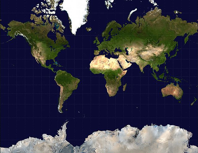
Proyeksi Mercator adalah proyeksi peta silinder yang dipopulerkan oleh kartografer Flandria Gerardus Mercator pada tahun 1569. Proyeksi ini dapat digunakan untuk peta navigasi pelayaran. Kelemahan proyeksi Mercator adalah proyeksi ini menyimpangkan luas daerah yang jauh dari khatulistiwa. Contohnya, jarak antara Norwegia dan Greenland menjadi terlihat begitu jauh, atau luas Greenland terlihat lebih besar dari Indonesia, yang sebenarnya lebih besar dari Greenland.

Remove ads
Pranala luar
- Ad maiorem Gerardi Mercatoris gloriam - contains high resolution images of the 1569 world map by Mercator.
- Table of examples and properties of all common projections, from radicalcartography.net.
- An interactive Java Applet to study the metric deformations of the Mercator Projection Diarsipkan 2017-09-07 di Wayback Machine..
Remove ads
Wikiwand - on
Seamless Wikipedia browsing. On steroids.
Remove ads
