Gładki Wierch
Z Wikipedii, wolnej encyklopedii
Z Wikipedii, wolnej encyklopedii
Gładki Wierch (niem. Glatter Berg, słow. Hladký štít, węg. Sima-hegy') – jeden z najniższych (2065 m) szczytów głównej grani Tatr w obszarze Tatr Wysokich, jednocześnie zwornik dla odchodzących od grani w kierunku południowo-zachodnim Liptowskich Kop, od których jest oddzielony przełęczą Zawory (na terytorium Słowacji). Leży pomiędzy Gładką Kotelnicą w grani Kotelnicy i Walentkowym Wierchem w grani głównej[1].
 Gładki Wierch. Poniżej Wole Oko i Zadni Staw Polski, powyżej z prawej – szczyt Krywania | |
| Państwo | |
|---|---|
| Położenie | |
| Pasmo | |
| Wysokość |
2065 m n.p.m. |
| Wybitność |
71 m |
Położenie na mapie Tatr 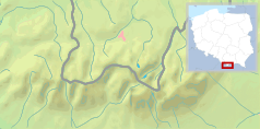 | |
Położenie na mapie Karpat  | |
Gładki Wierch od Walentkowego Wierchu oddzielony jest Gładką Przełęczą, z której prowadzi wygodne wejście na szczyt (droga jest zamknięta). Z kolei od Gładkiej Kotelnicy szczyt oddziela przełęcz Gładka Ławka. Odcinek grani między Gładką Ławką a Czarną Ławką to Kotelnica. Gładki Wierch wznosi się nad trzema dolinami: Doliną Pięciu Stawów Polskich, Doliną Kobylą i Doliną Wierchcichą. Z każdej z dolin jest łatwo dostępny. Najbardziej strome są jego stoki północno-wschodnie, jednak nie jest to ściana. Na szczycie jest tektoniczne pęknięcie[2].
Nazwa szczytu pochodzi od Gładkiego – północnych, opadających do dna Doliny Pięciu Stawów Polskich trawiastych zboczy[1].
Drogi prowadzące na szczyt były od dawna znane pasterzom. Nie sposób określić daty i nazwiska zdobywcy. Najstarsze odnotowane wejścia turystyczne:
W latach 1929–1930 na szczycie znajdowała się zimowa stacja badawcza meteorologów z Uniwersytetu Jagiellońskiego[4].


Seamless Wikipedia browsing. On steroids.
Every time you click a link to Wikipedia, Wiktionary or Wikiquote in your browser's search results, it will show the modern Wikiwand interface.
Wikiwand extension is a five stars, simple, with minimum permission required to keep your browsing private, safe and transparent.
