Provence-Alpes-Côte d'Azur
French administrative region From Wikipedia, the free encyclopedia

Remove ads
Provence-Alpes-Côte d'Azur or PACA (Occitan: Provença-Aups-Còsta d'Azur, Italian: Provenza-Alpi-Costa Azzurra) is one of the 18 administrative regions of France. Its capital is Marseille.


Remove ads
Geography

The Provence-Alpes-Côte d'Azur region is the tenth largest region of France with an area of 31,399.8 km2 (12,124 sq mi). It is in southeastern France and borders to the east with Monaco and Italy (with the Italian regions of Liguria and Piedmont). To the north is the Auvergne-Rhône-Alpes region and to the west is the Occitanie region.
To the south, the Provence-Alpes-Côte d'Azur has about 900 km (560 mi) of coast along the Mediterranean Sea.[3]
The distances from Marseille, the capital of the region, to other cities are:
- Paris, the national capital, 775 km (482 mi);
- Toulouse, 407 km (253 mi);
- Bordeaux, 645 km (401 mi);
- Lyon, 315 km (196 mi);
- Montpellier, 169 km (105 mi);
- Nice, 203 km (126 mi).
Rivers
The only main drainage basin in the region is the Mediterranean basin; some of the rivers in region are:
Mountains
The Barre des Écrins, at 4,102 m (13,458 ft), is the highest mountain of the Provence-Alpes-Côte d'Azur region.[4] It is in the Écrins National Park (French: Parc national des Écrins), one of the ten French national parks.
The highest point of the different departments in the Provence-Alpes-Côte d'Azur region are:[5]
Remove ads
Departments
The Provence-Alpes-Côte d'Azur region is formed by 6 departments:
Arr. = Arrondissements Cant. = Cantons Comm. = Communes
Remove ads
Demographics
The Provence-Alpes-Côte d'Azur region had, in 2014, a population of 4,983,438,[7] with a population density of 158.7 inhabitants/km2.

The main cities with more than 30,000 inhabitants (2014) in the region are:
Gallery
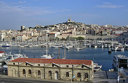 Marseille
 Nice
Nice Toulon
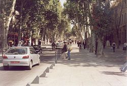 Aix-en-Provence
 Avignon


Related pages
References
Other websites
Wikiwand - on
Seamless Wikipedia browsing. On steroids.
Remove ads