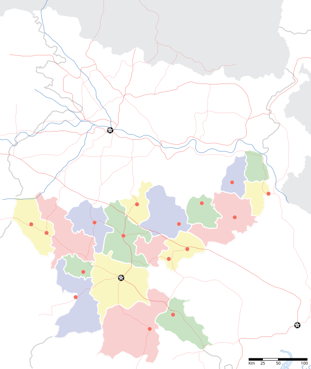
Jharkhand
From Wikipedia, the free encyclopedia
Ang Jharkhand (lit. "Bushland" or The land of forest) ay isang estado ng India na kinuha ng parte ng Bihar noong Nobyembre 15, 2000.[3] Ito ay pinalilibutan ng Bihar sa hilaga, Bihar Uttar Pradesh sa hilaga-kanluran, Chhattisgarh sa kanluran, Odisha sa timog, at West Bengal sa silangan.
Jharkhand | ||
|---|---|---|
 An immensely resource-rich state, Jharkhand suffers from resource curse | ||
| ||
 Location of Jharkhand | ||
 Map of Jharkhand | ||
| Mga koordinado (Ranchi): 23.35°N 85.33°E | ||
| Country | India | |
| Region | East India | |
| Formation | 15 November 2000 | |
| Capital | Ranchi | |
| Largest city | Jamshedpur | |
| Districts | 24 | |
| Pamahalaan | ||
| • Governor | Draupadi Murmu | |
| • Chief Minister | Raghubar Das (BJP) | |
| • Legislature | Unicameral (81 seats) | |
| • Parliamentary constituency | 14 | |
| • High Court | Jharkhand High Court | |
| Lawak | ||
| • Kabuuan | 79,714 km2 (30,778 milya kuwadrado) | |
| Ranggo sa lawak | 16th | |
| Populasyon (2011)[1] | ||
| • Kabuuan | 32,988,134 | |
| • Ranggo | 14th | |
| • Kapal | 414/km2 (1,070/milya kuwadrado) | |
| Sona ng oras | UTC+05:30 (IST) | |
| Kodigo ng ISO 3166 | IN-JH | |
| HDI | ||
| HDI rank | 19th (2007-08) | |
| Literacy | 67.6% (31th) | |
| Official language[2] | Hindi | |
| Websayt | jharkhand.gov.in | |
| †Formed by the Bihar Reorganisation Act, 2000 | ||
Mga sanggunian
Wikiwand in your browser!
Seamless Wikipedia browsing. On steroids.
Every time you click a link to Wikipedia, Wiktionary or Wikiquote in your browser's search results, it will show the modern Wikiwand interface.
Wikiwand extension is a five stars, simple, with minimum permission required to keep your browsing private, safe and transparent.

