File:Djibouti_relief_location_map.jpg
維基百科,自由的 encyclopedia
預覽大小:599 × 600 像素。 其他解析度:240 × 240 像素 | 479 × 480 像素 | 767 × 768 像素 | 1,023 × 1,024 像素 | 1,540 × 1,542 像素。
原始檔案 (1,540 × 1,542 像素,檔案大小:1.26 MB,MIME 類型:image/jpeg)
| 描述Djibouti relief location map.jpg |
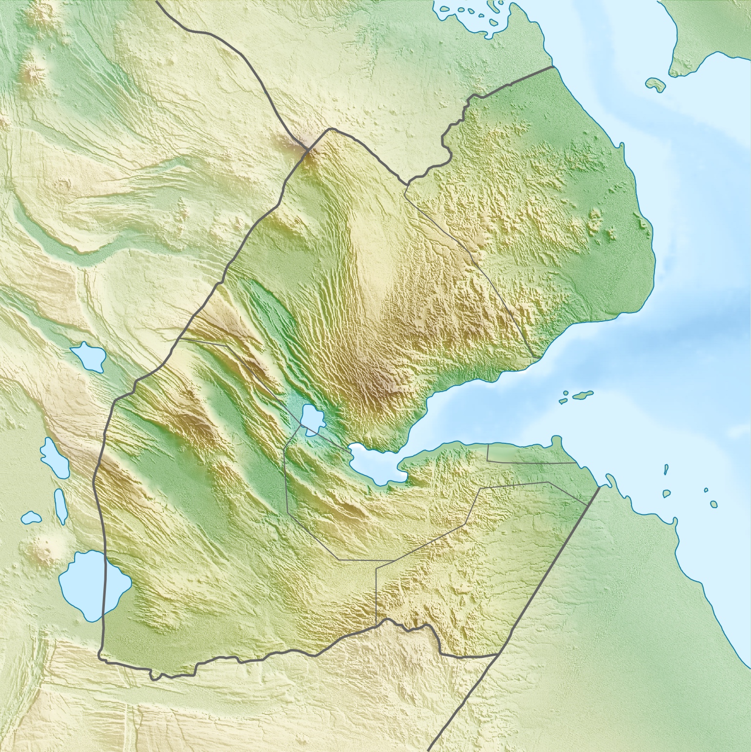
Deutsch: Physische Positionskarte von Dschibuti
Quadratische Plattkarte. Geographische Begrenzung der Karte:
English: Physical location map of Djibouti
Equirectangular projection. Geographic limits of the map:
|
| 日期 | |
| 來源 | 自己的作品, using map data from administrative map by NordNordWest. The relief was created from SRTM-3 relief data |
| 作者 | Carport |
| 授權許可 (重用此檔案) |
此檔案採用共享創意 姓名標示-相同方式分享 3.0 未在地化版本授權條款。
|
| 其他版本 |
|

說明
添加單行說明來描述出檔案所代表的內容
在此檔案描寫的項目
描繪內容
17 4 2010
檔案歷史
點選日期/時間以檢視該時間的檔案版本。
| 日期/時間 | 縮圖 | 尺寸 | 用戶 | 備註 | |
|---|---|---|---|---|---|
| 目前 | 2010年4月17日 (六) 08:53 | | 1,540 × 1,542(1.26 MB) | Carport | {{Information |Description={{de|Physische Positionskarte von {{w|Dschibuti|3=de}}}} Quadratische Plattkarte. Geographische Begrenzung der Karte: * N: 12.9° N * S: 10.7° N * W: 41.5° O * O: 43.7° O {{en|Physical location map of {{w|Djibouti}}}} Equirec |
檔案用途
下列2個頁面有用到此檔案:
全域檔案使用狀況
以下其他 wiki 使用了這個檔案:
- ar.wikipedia.org 的使用狀況
- ast.wikipedia.org 的使用狀況
- az.wikipedia.org 的使用狀況
- ba.wikipedia.org 的使用狀況
- be.wikipedia.org 的使用狀況
- bg.wikipedia.org 的使用狀況
- bn.wikipedia.org 的使用狀況
- bs.wikipedia.org 的使用狀況
- ceb.wikipedia.org 的使用狀況
- ce.wikipedia.org 的使用狀況
- ckb.wikipedia.org 的使用狀況
- cs.wikipedia.org 的使用狀況
- da.wikipedia.org 的使用狀況
- de.wikipedia.org 的使用狀況
- Dschibuti
- Assalsee (Dschibuti)
- Abbe-See
- Arta (Dschibuti)
- Golf von Tadjoura
- Vorlage:Positionskarte Dschibuti
- Wikipedia:Kartenwerkstatt/Positionskarten/Afrika
- Ardoukoba
- Benutzer:Carport/Galerie
- Holhol
- Ali Adde
- Loyada
- Goda-Massiv
- Mousa Alli
- Doumeira
- Musha (Insel)
- Sawabi-Inseln
- Oueah
- Ghoubbet-el-Kharab
- Damerjog
- Musha-Inseln
- Maskal
檢視此檔案的更多全域使用狀況。
詮釋資料
此檔案中包含擴展的資訊。這些資訊可能是由數位相機或掃描器在建立時或數位化過程中所加入。
如果此檔案的來源檔案已被修改,一些資訊在修改後的檔案中將不能完全反映出來。
| _error | 0 |
|---|