File:River_Tamar_map.png
维基百科,自由的 encyclopedia
本预览的尺寸:479 × 600像素。 其他分辨率:192 × 240像素 | 383 × 480像素 | 613 × 768像素 | 818 × 1,024像素 | 1,503 × 1,882像素。
原始文件 (1,503 × 1,882像素,文件大小:2.08 MB,MIME类型:image/png)
摘要
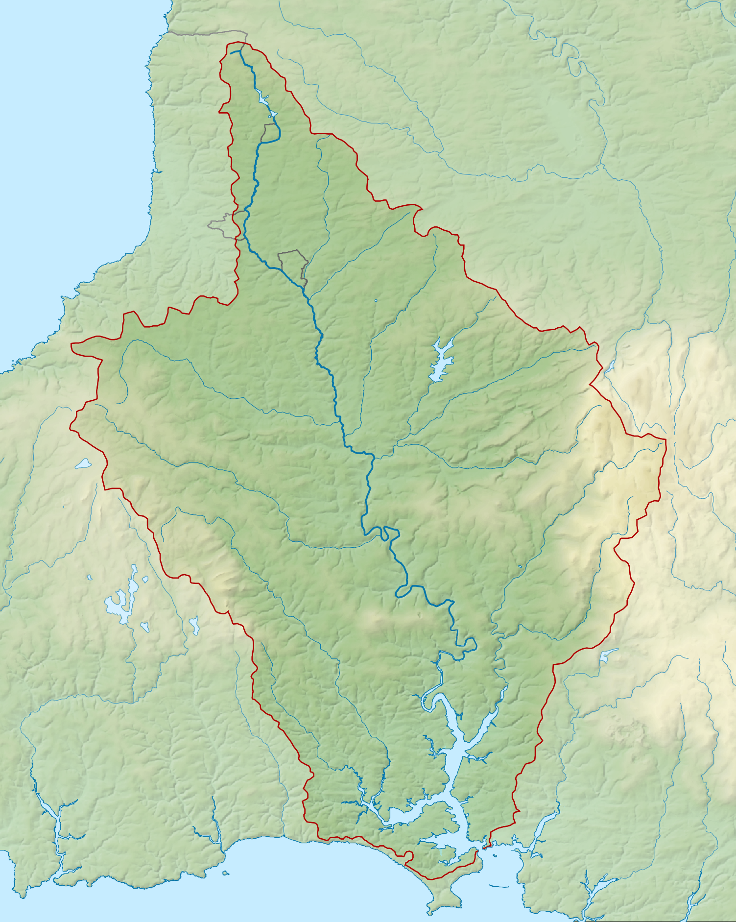
| 描述River Tamar map.png |
English: Map of the River Tamar and its catchment in Devon and Cornwall, UK. |
| 日期 | |
| 来源 |
|
| 作者 | Nilfanion, created using Ordnance Survey data |
| 授权 (二次使用本文件) |
本文件采用知识共享署名-相同方式共享 3.0 未本地化版本许可协议授权。 署名: Contains Ordnance Survey data © Crown copyright and database right
|
说明
添加一行文字以描述该文件所表现的内容
此文件中描述的项目
描绘内容
知识共享署名-相同方式共享3.0未本地化版本 简体中文(已转写)
21 2 2014
文件历史
点击某个日期/时间查看对应时刻的文件。
| 日期/时间 | 缩略图 | 大小 | 用户 | 备注 | |
|---|---|---|---|---|---|
| 当前 | 2014年2月21日 (五) 22:36 | | 1,503 × 1,882(2.08 MB) | Nilfanion | == {{int:filedesc}} == {{Information |Description= {{en|Map of the River Tamar and its catchment in Devon and Cornwall, UK.}} |Source=Ordnance Survey [https://www.ordnancesurvey.co.uk/opendatadownload/products.html OpenData]. *Rel... |
文件用途
以下页面使用本文件:
全域文件用途
以下其他wiki使用此文件:
- de.wikipedia.org上的用途
- en.wikipedia.org上的用途
- es.wikipedia.org上的用途
- fa.wikipedia.org上的用途
- fi.wikipedia.org上的用途
- hu.wikipedia.org上的用途
- io.wikipedia.org上的用途
- nl.wikipedia.org上的用途
- www.wikidata.org上的用途
元数据
此文件中包含有扩展的信息。这些信息可能是由数码相机或扫描仪在创建或数字化过程中所添加。
如果此文件的源文件已经被修改,一些信息在修改后的文件中将不能完全反映出来。
| 水平分辨率 | 67.32 dpc |
|---|---|
| 垂直分辨率 | 67.32 dpc |
| 文件修改日期时间 | 2014年2月13日 (四) 23:25 |