Bandarban District
District in Chittagong Division, Bangladesh / From Wikipedia, the free encyclopedia
Dear Wikiwand AI, let's keep it short by simply answering these key questions:
Can you list the top facts and stats about Bandarban District?
Summarize this article for a 10 year old
SHOW ALL QUESTIONS
Bandarban (Bengali: বান্দরবান, Chakma: 𑄝𑄚𑄴𑄘𑄧𑄢𑄴𑄝𑄚𑄴) is a district in South-Eastern Bangladesh, and a part of the Chittagong Division.[5] It is one of the three hill districts of Bangladesh and a part of the Chittagong Hill Tracts, the others being Rangamati District and Khagrachhari District. Bandarban district (4,479 km2) is not only the most remote district of the country, but also the least populous (population 388,000).[6] There is an army contingent at Bandarban Cantonment.
This article needs additional citations for verification. (January 2017) |
Quick Facts বান্দরবান, Country ...
Bandarban
বান্দরবান | |
|---|---|
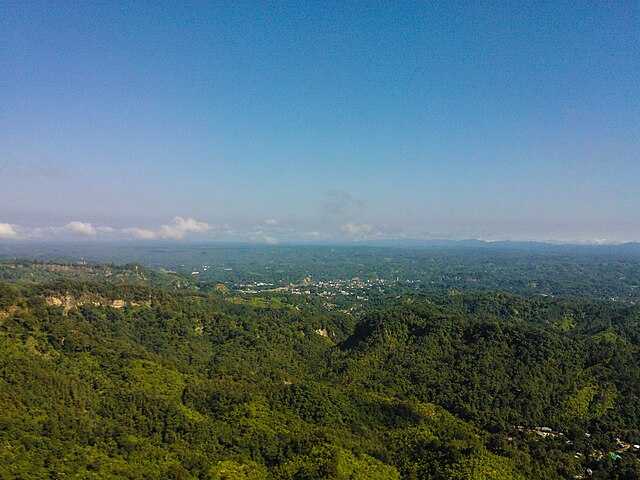
Clockwise from top-left: Nilachol, Jadipai waterfall, Keokradong, Buddha Dhatu Zadi, Boga lake | |
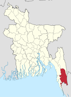
 Location of Bandarban in Bangladesh | |
 Expandable map of Bandarban District | |
| Coordinates: 21°48′N 92°24′E | |
| Country | |
| Division | Chittagong Division |
| As a District | 18 April 1981 |
| Government | |
| • MP | Bir Bahadur Ushwe Sing (Awami League) |
| • Deputy Commissioner | Yasmin Parvin Tibriji[1] |
| • District Council Chairman | Kya Show Hla[2] |
| • Chief Executive Officer | A. T. M. Kawser Hossain[2] |
| Area | |
| • Total | 4,479.01 km2 (1,729.36 sq mi) |
| Population (2022 census)[3] | |
| • Total | 481,109 |
| • Density | 110/km2 (280/sq mi) |
| Time zone | UTC+06:00 (BST) |
| HDI (2019) | 0.574[4] medium · 19th of 20 |
| Website | bandarban |
Close


