Kovylkinsky District
District in Republic of Mordovia, Russia / From Wikipedia, the free encyclopedia
Kovylkinsky District (Russian: Ковы́лкинский райо́н; Moksha: Лашмонь аймак, Lašmoń ajmak; Erzya: Ковёлбуе, Kovölbuje) is an administrative[1] and municipal[6] district (raion), one of the twenty-two in the Republic of Mordovia, Russia. It is located in the south of the republic. The area of the district is 2,013 square kilometers (777 sq mi).[3] Its administrative center is the town of Kovylkino (which is not administratively a part of the district).[2] As of the 2010 Census, the total population of the district was 22,523.[4]
Quick Facts Ковылкинский район, Other transcription(s) ...
Kovylkinsky District
Ковылкинский район | |
|---|---|
| Other transcription(s) | |
| • Moksha | Лашмонь район |
| • Erzya | Ковёлбуе |
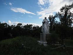
 Monument to Unknown Soldier, Kovylkinsky District | |
 Location of Kovylkinsky District in the Republic of Mordovia | |
| Coordinates: 54°02′N 43°55′E | |
| Country | Russia |
| Federal subject | Republic of Mordovia[1] |
| Established | 16 July 1928 |
| Administrative center | Kovylkino[2] |
| Area | |
| • Total | 2,013 km2 (777 sq mi) |
| Population | |
| • Total | 22,523 |
| • Estimate (2018)[5] | 38,280 (+70%) |
| • Density | 11/km2 (29/sq mi) |
| • Urban | 0% |
| • Rural | 100% |
| Administrative structure | |
| • Administrative divisions | 21 Selsoviets |
| • Inhabited localities[2] | 106 rural localities |
| Municipal structure | |
| • Municipally incorporated as | Kovylkinsky Municipal District[6] |
| • Municipal divisions[6] | 1 urban settlements, 21 rural settlements |
| Time zone | UTC+3 (MSK |
| OKTMO ID | 89629000 |
| Website | http://www.kovilkino13.ru |
Close
Quick Facts 2010 Census, 2002 Census ...
| 2010 Census | 22,523[4] |
|---|---|
| 2002 Census | 25,488[8] |
| 1989 Census | 33,488[9] |
| 1979 Census | 47,727[10] |
Close
