Newmarket, Ontario
Town in Ontario, Canada / From Wikipedia, the free encyclopedia
Dear Wikiwand AI, let's keep it short by simply answering these key questions:
Can you list the top facts and stats about Newmarket, Ontario?
Summarize this article for a 10 year old
Newmarket (2021 population: 87,942[5]) is a town and regional seat of the Regional Municipality of York in the Canadian province of Ontario. It is part of Greater Toronto in the Golden Horseshoe region of Southern Ontario. The name stems from the fact that the settlement was a "New Market",[6] in contrast to York as the Old Market.
This article needs additional citations for verification. (June 2018) |
Newmarket | |
|---|---|
| Town of Newmarket | |
 Newmarket's Old Town Hall, situated in the historic Main Street area | |
| Motto: "Prudence"[1] | |
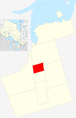
 Location of Newmarket within York Region | |
| Coordinates: 44°03′29″N 079°27′30″W[2] | |
| Country | Canada |
| Province | Ontario |
| Regional municipality | York Region |
| Settled | 1801 |
| Incorporated | 1857 (village) |
| Incorporated | 1880 (town) |
| Government | |
| • Type | Seat of York Region |
| • Mayor | John Taylor[4] |
| • Regional Councillor | Tom Vegh[4] |
| Area | |
| • Total | 38.50 km2 (14.86 sq mi) |
| Elevation | 239 m (784 ft) |
| Population | |
| • Total | 87,942 (70th) |
| • Density | 2,284.1/km2 (5,916/sq mi) |
| Time zone | UTC−05:00 (EST) |
| • Summer (DST) | UTC−04:00 (EDT) |
| Forward Sortation Area | |
| Area code(s) | 905, 289, 365, and 742 |
| Website | newmarket |
The town was formed as one of many farming communities in the area, but also developed an industrial centre on the Northern Railway of Canada's mainline, which was built in 1853 through what would become the downtown area.[7] It also became a thriving market town with the arrival of the Metropolitan Street Railway in 1899.[8] Over time, the town developed into a primarily residential area, and the expansion of Ontario Highway 400 to the west and the construction of Ontario Highway 404 to the east increasingly turned it into a bedroom town since the 1980s. The province's Official Plan includes growth in the business services and knowledge industries, as well as in the administrative, manufacturing and retail sectors.
Landmarks include Upper Canada Mall, Southlake Regional Health Centre, the Main Street Heritage Conservation District, and Wesley Brooks Conservation Area (locally called "Fairy Lake Park" or "Fairy Lake").[9]
