Top Qs
Timeline
Chat
Perspective
Aapsta
River in Georgia From Wikipedia, the free encyclopedia
Remove ads
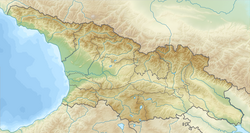
Aapsta[2] (Georgian: ააფსთა Abkhaz: Аапста) is a river in Abkhazia, Georgia. It originates on the southern slopes of the Achbikhvdar ridge in the Gudauta pass area in beech forests at 1445 meters above sea level;[3] flows into the Black Sea between the village Tskuara (Primorskoe) and the city Gudauta.
Remove ads
Physical and geographical characteristics
The length of the river is 35 kilometers, the catchment area is 243 km2, the slope of the river is 41.3 ‰, the prevailing width of the river is 15 meters, the depth is from 0.3 to 2.1 meters with a current speed of 1.3-1.6 m / s.[3]
In the middle and lower reaches of the coast, overgrown with beech-hornbeam forest. On the river are the villages Aats and Abgarhuk, at the mouth - the village Tskuara (Primorskoe).
The predominant type of feeding is snow feeding in the upper reaches; closer to the mouth, rain feeding becomes important. Average mineralization of waters is 213 mg / l. The type of water regime is the Black Sea, floods occur at all seasons.[3]
Through the Dokhurtu tributary, Aapsta is connected with the cave system Snezhnaya (Snowy) Cave.[4]
Tributaries
The Aapsta has 83 tributaries, the density of its river basin is 0.77 km / km2.[3] The main tributaries are:
- Dohurta - left tributary
- Mtsara - left tributary
- Dzish - left tributary
- Dry - left tributary
- Noisy - right tributary
- Fast - left tributary
- Spinal - left tributary
- Mtsaga - right tributary
Remove ads
Etymology
Hydronym comes from the Abkhaz language, from the Abkhazian "aaps" translates as "yew river".[5]
References
Wikiwand - on
Seamless Wikipedia browsing. On steroids.
Remove ads

