Top Qs
Timeline
Chat
Perspective
Apollo Temple
Landform in the Grand Canyon, Arizona From Wikipedia, the free encyclopedia

Remove ads
Apollo Temple is a 6,252-foot-elevation (1,906-meter) summit located in the Grand Canyon, in Coconino County of northern Arizona, in the southwestern United States.[2] It is situated four miles due east of Cape Royal on the canyon's North Rim, four miles northeast of Vishnu Temple, and a half-mile south-southeast of Venus Temple, which is the nearest higher neighbor. Topographic relief is significant as it rises over 3,600 feet (1,100 meters) above the Colorado River in less than two miles.


Apollo Temple is named for Apollo, god of the sun in Greek and Roman mythology.[3] This name was applied in 1902 by geologist François E. Matthes, in keeping with Clarence Dutton's tradition of naming geographical features in the Grand Canyon after mythological deities.[4] This feature's name was officially adopted in 1906 by the U.S. Board on Geographic Names.[2]
The top of Apollo Temple is composed of lower strata of the Pennsylvanian-Permian Supai Group. This overlays the cliff-forming layer of Mississippian Redwall Limestone, which in turn overlays Cambrian Tonto Group.[5] According to the Köppen climate classification system, Apollo Temple is located in a Cold semi-arid climate zone.[6] Precipitation runoff from Apollo Temple drains south to the Colorado River via Unkar and Basalt Creeks.
Remove ads
See also
Gallery
 Apollo Temple seen from Colorado River
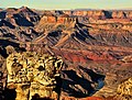 Apollo Temple centered
 View from Lipan Point with Apollo Temple centered, Jupiter Temple behind left, and Gunther Castle upper right
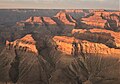 Apollo Temple lower left, Venus Temple lower right. Aerial view.
 Northeast aspect
 Major John Wesley Powell's boat with famous armchair.
Apollo Temple in the distance. circa 1869


References
External links
Wikiwand - on
Seamless Wikipedia browsing. On steroids.
Remove ads