Top Qs
Timeline
Chat
Perspective
Topographic isolation
Minimum horizontal distance to a point of equal elevation From Wikipedia, the free encyclopedia

Remove ads
The topographic isolation of a summit is the minimum horizontal distance to a point of equal elevation, representing a radius of dominance in which the peak is the highest point. It can be calculated for small hills and islands as well as for major mountain peaks and can even be calculated for submarine summits. Mount Everest, the highest point on Earth, has an undefined isolation, since there are no higher points to reference.[1]
A - Nearest higher neighbour
Because topographic isolation can be difficult to determine, a common approximation is the distance to a peak called the nearest higher neighbour (NHN).[2]
Remove ads
Isolation table
Summarize
Perspective
The following sortable table lists Earth's 40 most topographically isolated summits.
Remove ads
Examples
- The nearest peak to Germany's highest mountain, the 2,962-metre (9,718 ft) high Zugspitze, that has a 2,962-metre (9,718 ft) contour is the 2,988-metre (9,803 ft) Zwölferkogel in Austria's Stubai Alps. The distance between the Zugspitze and this contour is 25.8 kilometres (16 mi); the Zugspitze is thus the highest peak for a radius of 25.8 kilometres (16 mi). Its isolation is thus 25.8 kilometres (16 mi).
- Because there are no higher mountains than Mount Everest, it has no definitive isolation. Many sources list its isolation as the circumference of the Earth over the poles or – questionably, because there is no agreed definition – as half the Earth's circumference.
- After Mount Everest, Aconcagua, the highest mountain of the Americas, has the greatest isolation of all mountains. There is no higher land for 16,534 kilometres (10,274 mi). Its height is first exceeded by Tirich Mir in the Hindu Kush.
- Mont Blanc is the highest mountain of the Alps. The geographically nearest higher mountains are all in the Caucasus. Kukurtlu Dome, 4,978 metres (16,332 ft), is the reference peak for Mont Blanc.
- Musala is the highest peak in Rila mountain, also in Bulgaria and the Balkan Peninsula mountain system; standing at 2,925 m (9,596 ft) it is the fourth-most topographically isolated major peak in Continental Europe.[3] With a topographic prominence of 2,473 metres (8,114 ft), Musala is also the sixth-highest peak by topographic prominence in mainland Europe.[4]
Remove ads
Gallery
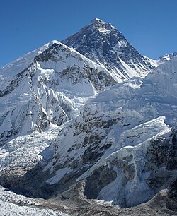 1. Mount Everest is the highest mountain peak on Earth.
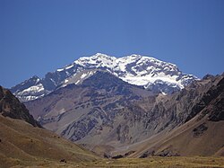
 3. Denali is the highest peak of North America.
 4. Kilimanjaro is the highest peak of Africa.
 6. The Vinson Massif is the highest peak of Antarctica.
 8. Mauna Kea on the Island of Hawaiʻi is the tallest mountain on Earth as measured from base on seafloor to summit.

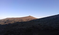 11. Thabana Ntlenyana in Lesotho is the highest point in southern Africa.
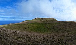 12. Ma′unga Terevaka is the highest point on Easter Island.
 13. Mont Blanc is the highest peak of Western Europe.
 14. Piton des Neiges is the apex of Réunion.
 15. Klyuchevskaya Sopka is the highest peak of Kamchatka.
 16. Pico de Orizaba is the highest peak of Mexico.
 17. Queen Mary's Peak is the highest point on the Atlantic island of Tristan da Cunha.
 18. Mount Whitney is the highest peak of the contiguous United States.
 19. Gunung Kinabalu is the apex of Borneo.
 20. Mount Elbrus is the highest peak of Europe.
 21. Pico da Bandeira is the third highest peak of Brazil.
 22. Mount Cameroon is the highest peak of Cameroon.


See also
References
External links
Wikiwand - on
Seamless Wikipedia browsing. On steroids.
Remove ads