Top Qs
Timeline
Chat
Perspective
Colorado State Highway 75
State highway in Colorado, United States From Wikipedia, the free encyclopedia
Remove ads
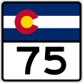
State Highway 75 (SH 75) is a Colorado state highway in Jefferson and Arapahoe counties. The southern terminus is at SH 470 in Columbine and the northern terminus is at Bowles Avenue in Littleton.
Remove ads
Route description
Over a total of 3.329 miles (5.358 km), SH 75 runs northeast on S. Platte Canyon Road from a partial interchange with SH 470 to an intersection with Lowell Boulevard and Bowles Avenue in Littleton.
History
Formerly, SH 75 continued into Littleton past the Lowell Blvd. intersection by turning east onto Bowles Ave. toward the junction with US 85. Past this junction, SH 75 would traverse a one-way couplet consisting of Alamo Avenue (eastbound) and Main Street (westbound), before the one-way streets merged into Littleton Boulevard.[2] At the Broadway intersection, SH 75 would turn north onto Broadway, where it would enter Englewood and eventually intersect SH 88 (Belleview Avenue). Finally, SH 75 would meet its historic end at US 285 in Englewood.[3]
Remove ads
Major intersections
References
External links
Wikiwand - on
Seamless Wikipedia browsing. On steroids.
Remove ads


