Top Qs
Timeline
Chat
Perspective
Japan National Route 1
Road from Tokyo to Osaka in Japan From Wikipedia, the free encyclopedia
Remove ads
National Route 1 (国道1号, Kokudō Ichi-gō) is a major highway on the island of Honshū in Japan. It connects Chūō, Tokyo in the Kantō region with the city of Osaka, Osaka Prefecture in the Kansai region, passing through the Chūbu region en route. It follows the old Tōkaidō westward from Tokyo to Kyoto, and the old Kyo Kaidō from there to Osaka. Between Tokyo and Aichi Prefecture it parallels the Tomei Expressway; from there to Mie Prefecture, the Higashi-Meihan Expressway, and from Shiga Prefecture to Osaka, the Meishin Expressway. It has a total length of 760.9 kilometers (472.8 mi). At its eastern terminus in Nihonbashi, Chūō, Tokyo, it meets National Routes 4, 6, 14, 15, 17, and 20. At its western terminus in Umeda, Kita-ku, Osaka, it links with Routes 2, 25, 26 and other highways.
You can help expand this article with text translated from the corresponding article in Japanese. (September 2012) Click [show] for important translation instructions.
|


National Route 1 links Tokyo to the important prefectural capitals of Yokohama (Kanagawa Prefecture), Shizuoka, Nagoya (Aichi Prefecture), Otsu (Shiga Prefecture), Kyoto, and Osaka.[2][3] It is the modern incarnation of the pre-modern Tōkaidō.
Remove ads
Route description
Summarize
Perspective

The main line of National Route 1 has a length of 638.4 kilometers (396.7 mi). When bypasses signed as National Route 1 are included, its total distance increases to 777.9 kilometers (483.4 mi).[4] Out of all of the national highways in Japan, it is the second longest land-based route after National Route 4,[5] though National Route 58 is the longest route when seabound routes are factored in.[6]
The highway's origin and eastern terminus lie at Nihonbashi in Tokyo's Chūō ward. At Nihonbashi it meets national routes 4, 6, 14, 15, 17, and 20. The highway passes through the cities of Kawasaki, Yokohama, Odawara, Numazu, Shizuoka, Hamamatsu, Nagoya, Yokkaichi, Ōtsu, and Kyoto. Its endpoint and western terminus lie in the Umeda district of Osaka's Kita ward. In Umeda, it has a junction with national routes 2, 26, 163, 165, 25, and 176.[4]
Overlapping sections
- In Chuo: Route 15
- From the origin to Chiyoda (Sakuradamon intersection): Route 20
- In Yokohama City, from Takashima-cho intersection to Hamamatsucho intersection: Route 16
- From Odawara City to Hakone Town (Miyanoshita intersection): Route 138
- From Hamamatsu City (Shinohara intersection) to Kosai City (Okurado IC): Route 42
Remove ads
History
National Route 1 was preceded by the Tōkaidō between Tokyo and Kyoto and the old Kyo Kaidō from Kyoto to Osaka. The road's construction was ordered by the first shōgun of the Edo period, Tokugawa Ieyasu. It served to link the old capital of Japan, Kyoto, to Tokugawa's new capital, Edo. The Tōkaidō's post stations, known in Japanese as shukuba, were captured by the printmaker Utagawa Hiroshige in his ukiyo-e prints, The Fifty-three Stations of the Tōkaidō.[7]
In 1919, the first Road Act was passed, establishing a highway also called National Route 1 between Tokyo and the city of Shingū in Wakayama Prefecture partially along the current route.[8] On 4 December 1952 the route was designated by the Cabinet of Japan as Primary National Highway 1 between Tokyo and Osaka, establishing the highway almost entirely along its current routing. On 1 April 1965 the route was redesignated as General National Route 1.[9]
Remove ads
Junction list
Summarize
Perspective
All junctions listed are at-grade intersections unless noted otherwise.
Remove ads
See also
- Gokishichidō, the ancient highways of Japan
Gallery
 Nihonbashi, Tokyo terminus
 Route 1 passes in front of the Imperial Palace in Tokyo.
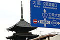
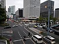 Western terminus of Route 1 in Umeda
 Route 1 heading through Shiba towards Tokyo Tower


References
External links
Wikiwand - on
Seamless Wikipedia browsing. On steroids.
Remove ads