Top Qs
Timeline
Chat
Perspective
List of Interstate Highways in California
From Wikipedia, the free encyclopedia

Remove ads
This is a list of Interstate Highways in the U.S. state of California that have existed since the 1964 renumbering. It includes routes defined by the California State Legislature but never built, as well as routes entirely relinquished to local governments.
.svg)
.svg)
.svg)

Each state highway in California is maintained by the California Department of Transportation (Caltrans) and is assigned a Route (officially State Highway Route[1][2]) number in the Streets and Highways Code (Sections 300-635). Under the code, the state assigns a unique Route X to each highway and does not differentiate between state, US, or Interstate highways.
Remove ads
Overview
- U.S. Routes and state highways that traverse California are also defined in the California Streets and Highways code as state routes. This list does not include these state routes as they are listed separately.
- A few cases exist, such as I-110, where a defined California State Route partially overlaps with a federally defined Interstate Highway, while the remaining portion is signed as a state highway. This table only addresses the portion signed as a Interstate in these cases.
- One Interstate Highway—I-305—is defined only federally; the state calls it part of US 50. It was signed as part of Business Interstate 80, the only state-maintained Interstate business route in California.
- Conversely, a few segments exist that are not part of a federally defined Interstate Highway but are still signed as such by Caltrans. Examples include I-80's westernmost segment between US 101 and the Bay Bridge.
- Lengths for each state route were initially measured as they existed during the 1964 state highway renumbering (or during the year the route was established, if after 1964), and do not necessarily reflect the current mileage.
- The years listed reflect when the route was affected by legislative action, this is not necessarily the same year as the actual construction or signing changes to the route.
- Concurrencies are not explicitly codified in the Streets and Highways Code; such highway segments are listed on only one of the corresponding legislative route numbers. For example, the I-80/I-580 concurrency, known as the Eastshore Freeway, is only listed under Route 80 in the highway code while the definition of Route 580 is broken into non-contiguous segments. When a highway is broken into such segments, the total length recorded by Caltrans only reflects those non-contiguous segments and does not include those overlaps that would be required to make the route continuous. Furthermore, Caltrans may not sign all concurrencies, and instead may only post the highway shields for the route with the contiguous segment in the code.
- Some highways are not contiguous as the state has relinquished control of small sections to local governments. The stated length of the highway may or may not reflect the portions under local control.
Remove ads
Primary Interstates
 I-5 southbound approaching Mount Shasta
 I-8 in Alpine
 I-10 eastbound with the San Gorgonio Pass wind farm in the background
 I-15 northbound descending into the Ivanpah Valley towards Primm, Nevada at the California-Nevada state line
 I-40 eastbound near Fenner
 I-80 eastbound in the Sierra Nevada from the Yuba Gap overpass towards the western approach to Donner Summit


Remove ads
Auxiliary Interstates
 Construction on I-215 between Inland Center Drive and Orange Show Road in San Bernardino
 I-280 running along near Stanford University
 Cars driving on I-405 through the Sepulveda Pass
 I-580 winding through the Altamont Pass wind farm
 I-605 northbound approaching its northern terminus with I-210
 I-680 northbound descending from Mission Pass
 An empty I-805 at its interchange with I-8 in San Diego's Mission Valley
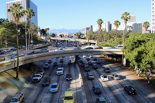 Rush hour on I-110 in Los Angeles


.jpg)


Remove ads
Business Routes
Summarize
Perspective
Interstate business routes in California are assigned by the California Department of Transportation (Caltrans), but are not maintained by Caltrans unless they overlay other routes of the state highway system. Local authorities may request route assignment from the Caltrans Transportation System Information Program, and all requests require approval of the executive committee of the American Association of State Highway and Transportation Officials (AASHTO).[4]
Remove ads
See also
Notes
- Lengths rounded to the nearest mile or one-mile are estimated from various sources including Google Maps.
- Part of one of the contiguous routes that is partially signed as an Interstate Highway, while the remaining segment is signed as a state highway.
- This route is broken into pieces due to a gap in the description, unfilled by any route.
Remove ads
References
Wikiwand - on
Seamless Wikipedia browsing. On steroids.
Remove ads