Top Qs
Timeline
Chat
Perspective
List of Puerto Rico state forests
From Wikipedia, the free encyclopedia

Remove ads
Puerto Rico state forests (Spanish: Bosques estatales de Puerto Rico), sometimes referred to as Puerto Rico Commonwealth forests in English,[1][2] are protected forest reserves managed by the government of Puerto Rico, particularly by the Puerto Rico Department of Natural and Environmental Resources. In addition to their function as protected forest reserves, many of the forests are analogous to state parks in other states and territories of the United States, as they also function as management units that cater to recreational, educational and cultural activities.[3][4] Additionally, state forests in Puerto Rico can contain units with additional protection designations within their boundaries, as is the case of La Parguera Natural Reserve within Boquerón State Forest,[5] for example. There are currently 20 units in the Puerto Rico state forest system.[6]
Remove ads
History
Summarize
Perspective
The first protected forests in Puerto Rico were designated not for their ecological value but for their industrial timber utility in the form of Spanish Crown Lands under the Inspección de Montes, the equivalent of the Spanish Colonial Forest service. El Yunque, for example, was the first forested area to receive this designation in Puerto Rico.[7]
Puerto Rico became a territory of the United States in the aftermath of the Spanish-American War in 1898 and, in 1903, President Theodore Roosevelt set aside these former timberlands to proclaim the Luquillo Forest Reserve, the first ecologically protected area in the island.[8] Meanwhile, on the state level, colonial governor Arthur Yager set aside mangrove forests along the coasts of Puerto Rico for their ecological value between 1918 and 1919: Aguirre,[9] Boquerón,[10] Ceiba,[11] and Guánica.[12] The latter had its boundaries extended in order to protect a large tract of dry forest, a type of ecosystem that used to be common in the Caribbean but had now almost completely disappeared.[13] These became the first state or territorial-level protected forests in the island and, in December 1919, ownership of the federally protected forest tract in the westernmost portion of the Cordillera Central passed to the territorial government, making the Maricao Forest the first woodland to receive this designation.[14]
By 1935 all the newly protected woodlands of Puerto Rico under were consolidated as part of the Caribbean National Forest, which was then divided into the areas of the Sierra de Luquillo (El Yunque) and the Cordillera Central (Guilarte and Toro Negro).[14][15] In addition to their natural resources these areas were also managed as tourist attractions, something that is evident in the territory-wide construction projects of visitor infrastructure by the Civilian Conservation Corps during the 1930s Roosevelt presidency. Many of these structures and buildings today possess historical and architectural value, and some are listed in the National Register of Historic Places as New Deal Era Constructions in the Forest Reserves of Puerto Rico (1933-1942).[16][17] A notable example of these is the Santa Ana Observation Tower, popularly called La Torre de Piedra.[18] It was during this time that the ownership of the western portions of the Caribbean National Forest passed to the territorial government, creating Toro Negro in 1934 and Guilarte, which was separated from the latter, in 1935.[19][20] In the following decades, previously designated natural reserves such as Carite, Guajataca and Rio Abajo were given the additional designation of state forest. Several of the forest, such as Bosque del Pueblo, San Patricio and Monte Choca, have gained their protected designation thanks to the actions of grassroots movements and local community actions.[21][22]
Remove ads
List of Puerto Rico state forests
Summarize
Perspective
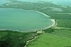
The following are Puerto Rico state forests. [note 1]

.jpg)


_(6499240363).jpg)


.jpg)

.jpg)


Key:
B = Boating
C = Camping
F = Fishing
G = Photography
H = Hiking
K = Kayaking
O = Nature Observation
P = Picnicking
R = Scientific Research
S = Swimming
W = Bird Watching
Remove ads
See also
Notes
- Note on the area: As of August 2013, the Government of Puerto Rico is engaged in an ongoing plan of land purchase for the purpose of increasing its inventory of state forest land area. As a result the area figures given in this table should only be taken as approximations. Also, land measurements in Puerto Rico are given in cuerdas (one cuerda equals to 0.97 acres), and, as such, references to forest size below have been converted to acres to keep all such measurements standard throughout this article.
Remove ads
References
External links
Wikiwand - on
Seamless Wikipedia browsing. On steroids.
Remove ads