Top Qs
Timeline
Chat
Perspective
Nut Tree Airport
Airport From Wikipedia, the free encyclopedia

Remove ads
Nut Tree Airport (ICAO: KVCB, FAA LID: VCB, formerly O45) is a county-owned public-use airport located two nautical miles (3.7 km) northeast of the central business district of Vacaville, in Solano County, California, United States.[1]
.jpg)

The airport is near the junction of Interstates 80 and 505.[2] It is adjacent to the Nut Tree retail/commercial development, which replaced a historic US 40 highway stop from which both derive their name.
Remove ads
History
The Nut Tree Airport was founded in 1955 by Ed Power Jr., an aviation enthusiast and the son of Nut Tree founders Ed "Bunny" Power Sr. and Helen Harbison Power, as a way of attracting aviators to the Nut Tree.[3] The family sold the airport to Solano County in the 1970s.[4]
Facilities and aircraft
Nut Tree Airport covers an area of 262 acres (106 ha) at an elevation of 117 feet (36 m) above mean sea level. It has one runway designated 2/20 with an asphalt surface measuring 4,700 by 75 feet (1,433 x 23 m).[1]
For the 12-month period ending March 21, 2022, the airport had 87,000 aircraft operations, an average of 238 per day: 97% general aviation and 2% air taxi. At that time there were 214 aircraft based at this airport: 189 single-engine, 19 multi-engine and 6 helicopters.[1]
Remove ads
Gallery
 Nut Tree Airport sign in Vacaville
 Nut Tree Airport
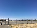 Planes at the Nut Tree Airport
 Nut Tree airport building with planes in background
 Wilgas Formation taking off at Nut Tree
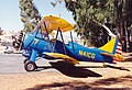 Waco UPF-7 at Nut Tree
 P-51D N151D taking off at Nut Tree


.jpg)
.jpg)
.jpg)
References
External links
Wikiwand - on
Seamless Wikipedia browsing. On steroids.
Remove ads