Top Qs
Timeline
Chat
Perspective
Puerto Rico Highway 52
Highway in Puerto Rico From Wikipedia, the free encyclopedia

Remove ads
Puerto Rico Highway 52 (PR-52), a major toll road in Puerto Rico, is also known as Autopista Luis A. Ferré. It was formerly called Expreso Las Américas. It runs from PR-1 in southwest Río Piedras and heads south until it intersects with highway PR-2 in Ponce.[3] PR-52 is Puerto Rico's longest and second most traveled tollway. The road is mostly a 2-lane road in each direction. Toll stations are located in San Juan, Caguas, Salinas, Juana Díaz, and Ponce. The speed limit from San Juan to Caguas is 55 miles per hour (89 km/h). From Caguas to Salinas, it is 45 miles per hour (72 km/h), and from Salinas to Ponce, it is 65 miles per hour (105 km/h).


Remove ads
Route description
Summarize
Perspective
At its north end, the short PR-18 continues from north to south along PR-52 towards Hato Rey and Santurce. This short segment is known as Expreso Las Américas, the only segment of the route still unofficially bearing this name, since PR-18 is now officially named Roberto Sánchez Vilella Expressway. The combined route of PR-18 and PR-52 runs concurrent with the unsigned US Interstate Highway PRI-1. PR-52 continues southward along Cupey and Caimito, crossing the westernmost edge of the Sierra de Luquillo in Trujillo Alto on the way to Caguas. In Caguas, it crosses the Valley of Caguas, where it functions as a north-south bypass for local traffic, before elevating south into the Sierra de Cayey.
 PR-52 south at its exit to PR-1 south in San Juan
 PR-52 south approaching exits 1A-B to PR-177 in San Juan
 Heading south in San Juan
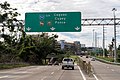
 PR-52 south at exit 2 to PR-199 in San Juan
 Heading south in Trujillo Alto
 Heading south in Caguas


.jpg)
.jpg)
.jpg)
.jpg)
In Cayey, PR-52 passes extremely close to the municipality of Cidra between approximately kilometer markers 34 and 30. In fact, Exit 32 to Guavate is so close to the Cidra border that once the exit is taken and instead of going south to Guavate and Patillas through PR-184, going north it quickly ends at PR-1 and a welcome sign to Cidra is shown. The tollway itself never enters Cidra itself, but PR-1 (the parallel road from Ponce to San Juan) does.
The speed limit is reduced in the section between Cayey and Salinas crosses the Sierra de Cayey, resulting in a more curvy and hilly section than the other sections of the highway. Located at the orographic lift of the Cordillera Central, it also experiences more fog and lower visibility than the rest of the road due to the altitude. This is also the highest point of the route. One of Puerto Rico's only 2 rest areas is located on this section of the expressway in Salinas. (map) The other rest area is located on PR-53 (northbound only) near Humacao/Naguabo municipality border and, just like the rest area on PR-52, it has no operating facilities. (map) The rest area does provide view of a pair of important landmarks, the Monumento al Jíbaro Puertorriqueño and the famous Tetas de Cayey.
Beginning at the leeward side of Salinas, between here and Ponce, PR-52 crosses the southern coastal plain of Puerto Rico, crossing Santa Isabel and Juana Díaz. The route finally enters the urban area of Ponce at barrio Sabanetas, marked by the famous Letras de Ponce landmark.
 Heading southwest in Cayey
 View from PR-52 in Cayey
 The Monumento al Jíbaro Puertorriqueño and Las Tetas de Cayey
 Heading southwest in Salinas
 A Toyota Tacoma pick-up truck on PR-52 south, with water and flag, after Hurricane Maria (2017)
 Heading northwest in Santa Isabel
 Heading west in Ponce
.jpg)


-1.jpg)

.jpg)
Express lanes
In 2021, the Puerto Rico Department of Transportation and Public Works and the Puerto Rico Highways and Transportation Authority inaugurated express lanes with dynamic tolling (DTL) between San Juan and Caguas to help alleviate traffic congestion during peak hours.[4] These reversible lanes extends from PR-18, near Río Piedras Medical Center, to the Caguas Norte Toll Plaza with a variable rate between $0.50 and $6.00 per direction.[5] The speed limit on the nearly 14-kilometer route ranges between 50 and 55 miles per hour (80–90 km/h). It is expected that in the long term the lanes will be extended to PR-30 heading to Gurabo.[6]
Remove ads
History
Summarize
Perspective
The building of this 108-kilometer (67 mi)[7] expressway took place during the administration of governor Luis A. Ferré, who was trained as a civil engineer himself. [8] It was built at a cost of $125 million.[9] PR-52 was Puerto Rico's first toll road ever. Construction for this road started in October 1968 during the administration of governor Roberto Sánchez Vilella, also a trained engineer, and continued during Luis Ferre's tenure. It was then named Autopista Las Américas, and it was planned to run from San Juan to Ponce.[2] The expressway is currently the longest in the island, but this will change when the 83-km-long PR-22 extends to Aguadilla. In March 1969 the roadway became a tolled expressway. The Puerto Rico Highway and Transportation Authority reports that tolls were added to the highway to speed up its construction.[2] The road was completed in 1975 during the first administration of governor Rafael Hernández Colón.[10] On 9 December 1993, Law 118 was enacted which renamed the roadway Autopista Luis A. Ferré.[2] On 2007, construction of a suburban rail line connecting San Juan to Caguas to be built along PR-52 was announced by governor Aníbal Acevedo Vilá.[11] After years of planning stagnation and the implementation of new AMA bus routes along reversible lanes, the project was cancelled in 2017 due to lack of funding.[12]
The Las Américas section of PR-52/PR-18 along Hato Rey has been the setting of multiple mass protests in recent history. On February 21, 2000, more than 150,000 people participated in a mass protest against the United States Navy occupation of Vieques.[13] On 22 July 2019, more than half a million protestors shut down this section demanding the resignation of the then governor, Ricardo Rosselló, following a leaked Telegram chat between the governor and several members of his cabinet.[14]
Remove ads
Tolls
Exit list
Remove ads
See also
References
External links
Wikiwand - on
Seamless Wikipedia browsing. On steroids.
Remove ads