Top Qs
Timeline
Chat
Perspective
Puerto Rico Highway 12
Highway in Puerto Rico From Wikipedia, the free encyclopedia

Remove ads
Puerto Rico Highway 12 (PR-12), also called Avenida Malecón,[3] and Avenida Santiago de los Caballeros, is a 6.4-kilometer,[4] limited-access highway entirely located within the city limits of Ponce, Puerto Rico, and connecting Puerto Rico Highway 14 to the La Guancha area in Barrio Playa in Ponce.[5] It is similar to a freeway but has one traffic light near its intersection with PR-14. In addition to its northern and southern terminus, the highway has four full interchange exits: PR-52, PR-2, PR-133/Calle Comercio, and Avenida Las Américas. Since PR-12's southern terminus is at the Port of Ponce, its traffic volume is expected to grow as construction in the new Port of the Americas is completed.[6]

Remove ads
Route description
With a length of about 6.4 kilometers (4.0 mi), PR-12 begins at PR-14 (Avenida Tito Castro) intersection in Barrio Machuelo Abajo. PR-12 also intersects with Calle Obispado in Machuelo Abajo. Then, PR-12 enters Barrio San Antón, where meets with PR-1 (Boulevard Miguel Pou), PR-133 (Calle Comercio) and PR-163 (Avenida Las Américas) interchanges, and crosses the Río Portugués. After the river, PR-12 has an interchange with PR-2 (Ponce Bypass) between San Antón and Playa. In Barrio Playa, PR-12 has interchanges with Avenida Rafael Cordero Santiago, PR-52 (Autopista Luis A. Ferré) and Avenida Caribe, with intersections with Calle Puerto Viejo and PR-123 just before its southern terminus at the Port of Ponce and La Guancha. Most of the route has three lanes per direction, except in the southern terminus, where there are two lanes in both directions.[1]
Remove ads
History
 Southbound lanes of PR-12, near exit to PR-133 (Calle Comercio), in Ponce
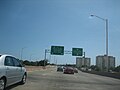 2008 PR-12 photo with old PR-14 signing
 Detailed map of PR-12
,_en_Ponce,_PR_(DSC01665).jpg)
,_en_Barrio_San_Antón,_Ponce,_PR,_mostrando_antiguo_letrero_de_la_PR-14.jpg)
.svg)
The 2.5 kilometer section of this road, from the Ponce Bypass to just a few feet from the Caribbean Sea at PR-123, was the first segment built; it was built in 1960.[2] It was called "Avenida Malecón" (Pier Avenue), as it led from the then-urbanized area of Ponce to the Ponce wharf. The segment north of PR-12's intersection with PR-2, that is, between PR-2 and Avenida Tito Castro was built in the 1990s, and completed in 2002, as part of the Ponce en Marcha project.[7]
PR-12 used to be signed as part of 'PR-14' before construction of the new PR-10 took place. The PR-14 signing has since been moved into another route (ending at Monumento a la abolición de la esclavitud, near downtown Ponce, while the PR-12 signing was assigned to the southernmost 5.28 kilometers of the old PR-14 route. As of 2008, the Puerto Rico Department of Transportation and Public Works had not yet updated the signing on the road, but by 2011 it had.
Remove ads
Major intersections
The entire route is located in Ponce. All exits are unnumbered.
 PR-12 north at its exit to Avenida Caribe
 PR-12 north at its exit to Avenida Rafael Cordero Santiago
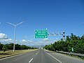
 PR-12 north near its exit to PR-163 (Avenida Las Américas)
.jpg)
.jpg)
.jpg)
- Avenida Las Américas is also known as Bulevar Luis A. Ferré.
Remove ads
See also
Notes
References
External links
Wikiwand - on
Seamless Wikipedia browsing. On steroids.
Remove ads