Top Qs
Timeline
Chat
Perspective
Poltava Governorate
1802–1925 unit of Russia in present day Ukraine From Wikipedia, the free encyclopedia
Remove ads
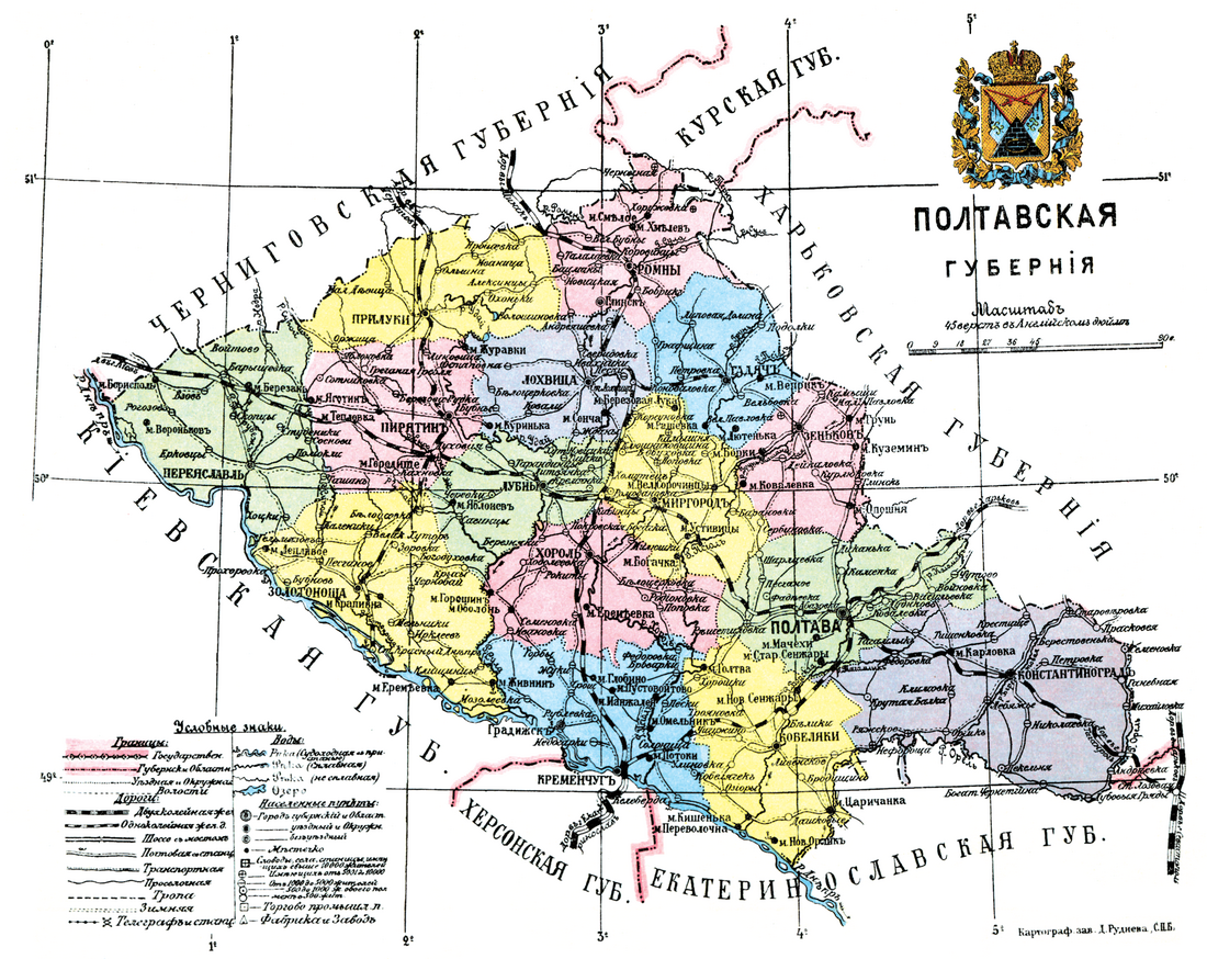
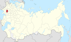
Poltava Governorate[a] was an administrative-territorial unit (guberniya) of the Russian Empire. It was officially created in 1802 from the disbanded Little Russia Governorate and had its capital in Poltava.
Its borders encompassed the modern Poltava Oblast of Ukraine, in addition to Berestyn, Pereiaslav, Romny and Zolotonosha.
It was bordering the Chernigov and Kursk Governorates to the north, Kiev Governorate to the west, Kharkov Governorate to the east and the Kherson and Yekaterinoslav Governorates to the south.
Remove ads
History
In 1802, the Little Russia Governorate was disbanded and its territory split between the new Chernigov and Poltava Governorates.
The governorate was part of the Ukrainian People's Republic from 1917 to 1920, interrupted in 1918 by the Ukrainian State.
After the formation of the Ukrainian SSR, the territory was wholly included into the new Soviet Republic. Initially the governorate system was retained – although variations included the Kremenchug Governorate which was temporarily formed on its territory (August 1920 – December 1922), and the passing of the Pereyaslavsky Uyezd to the Kiev Governorate. However, on June 3, 1925, the governorate was liquidated and succeeded by five okruhas (which already were its subdivisions as of March 7, 1923): Kremenchutsky, Lubensky, Poltavsky, Prylutsky and Romensky (the remaining two okrugs existed within the governate, Zolotonoshsky and Krasnohradsky, were also liquidated).
Remove ads
Demographics
Summarize
Perspective
The governorate had a population of 2,778,151 according to the 1897 Russian Empire census.[1] Most people (90.13%) lived on the countryside, while a tenth (9.87%) lived in towns and cities.[2][3] In 1914, the population had increased to 2,794,727.[citation needed]
Largest towns and cities
According to the 1897 census, nine settlements had more than 10,000 people.

– Great Russians, – Little Russians
- Kremenchug – 63,007 (Jewish – 29,577, Ukrainian – 18,980, Russian – 12,130)
- Poltava – 53,703 (Ukrainian – 30,086, Russian – 11,035, Jewish – 10,690)
- Romny – 22,510 (Ukrainian – 13,856, Jewish – 6,341, Russian – 1,933)
- Priluki – 18,532 (Ukrainian – 11,850, Jewish – 5,719, Russian – 821)
- Pereyaslav – 14,614 (Ukrainian – 8,348, Jewish – 5,737, Russian – 468)
- Kobeliaki – 10,487 (Ukrainian – 7,708, Jewish – 2,115, Russian – 564)
- Zenkov – 10,443 (Ukrainian – 8,957, Jewish – 1,261, Russian – 187)
- Lubny – 10,097 (Ukrainian – 5,975, Jewish – 3,001, Russian – 960)
- Mirgorod – 10,037 (Ukrainian – 8,290, Jewish – 1,248, Russian – 427)
In bold are cities with a population of over 50,000.
Native Languages
By the 1897 census,[4] Ukrainian was by far the most native spoken language in the governorate, followed by Yiddish and Russian.

Comparison with other governorates (1897)
– Great Russians, – Little Russians
In bold are native languages spoken by more people than the state language.
Religion
By the 1897 census,[5] the majority religion in the governorate and virtually the state religion was Eastern Orthodox Christianity with some of the population following Judaism. Other religions were much less common.
Remove ads
Administrative divisions
Summarize
Perspective
The governorate was divided into 15 uezds (povits in Ukrainian):
Notes
- Russian: Полтавская губерния, pre-1918: Полтавская губернія, romanized: Poltavskaya guberniya
- Ukrainian: Полтавська губернія, romanized: Poltavsʼka huberniia
References
External links
Wikiwand - on
Seamless Wikipedia browsing. On steroids.
Remove ads


