Top Qs
Timeline
Chat
Perspective
Puerto Rico Highway 14
Highway in Puerto Rico From Wikipedia, the free encyclopedia

Remove ads
Puerto Rico Highway 14 (PR-14) is a main highway connecting Ponce to Cayey, Puerto Rico.[2] The road runs the same course as the historic Carretera Central. The Ponce-to-Coamo section of PR-14 was built under the direction of Spanish engineer Raimundo Camprubí Escudero (b. Pamplona 15 March 1846 – d. Madrid 1924).[3]
 Avenida Tito Castro (PR-14), Barrio Machuelo Abajo, Ponce, looking west (PR-14, near km 4.4)
 PR-14 westbound at bridge over Río Bucaná on Avenida Tito Castro in Ponce approaching PR-10 (PR-14, near km 5.2)
,_Bo._Machuelo_Abajo,_Ponce,_Puerto_Rico,_mirando_al_oeste_(IMG_3417).jpg)


Remove ads
Route description
Except in the city of Ponce where (with the exception of the Ponce Historic Zone) the road is a 4-lane road known as Avenida Tito Castro, the rest of PR-14 is a two-lane country road as it makes its way through the four towns it runs through, Juana Díaz, Coamo, Aibonito and Cayey.[4] PR-14 is one of the roads that lead into the Ponce Historic Zone.[5]
 A former Casilla de Caminero on PR-14 (now Avenida Tito Castro) in Ponce (PR-14, near km 3.1)
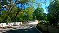 Puente de las Calabazas in Coamo (PR-14, near km 38.8)
 Detailed map of PR-14 in the municipality of Ponce
,_Barrio_Machuelo_Abajo,_Ponce,_PR_(DSC04978).jpg)

.svg)
Remove ads
Major intersections
 PR-14, PR-10, and PR-1 signs in downtown Ponce (at Calle Villa and Calle Concordia, near PR-14, km 0.2), looking east
 PR-14 eastbound (Avenida Tito Castro) intersection with Avenida Fagot, Ponce (PR-14, km 3.0)

,_Bo._Machuelo_Abajo,_Ponce,_Puerto_Rico,_visto_desde_intersección_con_la_Av._Fagot,_mirando_al_este_(DSC02967).jpg)
Remove ads
Related route
Puerto Rico Highway 14R (Spanish: Carretera Ramal 14, abbreviated Ramal PR-14 or PR-14R) is a road that branches off from PR-14 and ends at PR-123 in downtown Ponce. Its route is part of Unión and Guadalupe streets.[10][11] The entire route is located in Ponce.
 Puerto Rico Highway 14R through Calle Unión, near km 0.5
 Puerto Rico Highway 14R through Calle Guadalupe, near km 0.9
.jpg)
.jpg)
See also
References
External links
Wikiwand - on
Seamless Wikipedia browsing. On steroids.
Remove ads