Top Qs
Timeline
Chat
Perspective
Queens directories
Directories of the Borough of Queens, New York City From Wikipedia, the free encyclopedia

Remove ads
Queens Directories – of New York City – were, before 1898, an assortment of village directories, Queens County directories, Long Island Directories, and add-ins or partial inclusions to New York City directories. In 1898, 30% of the western part of the old Queens County was absorbed into New York City. Before 1898, Nassau County covered the eastern 70% of the old Queens County. The older, larger Queens County was mostly agricultural, and within it were several towns, villages, and hamlets. In the mid- to late-19th century, cemeteries constituted one of the larger industries in Queens, Kings (Brooklyn), and Westchester (north of The Bronx) Counties. As of 1898, Queens County, New York, and the Borough of Queens, New York City, geographically, have been the same. Both Queens and Brooklyn are on Long Island. (this article includes selected bibliography and selected timelines that help identify people of Queens throughout its history)
This article's use of external links may not follow Wikipedia's policies or guidelines. (November 2021) |
Remove ads
Timeline and highlights
Summarize
Perspective
Pre-consolidation (before 1898) towns, villages, and communities
Selected name origins
Post-consolidation (after 1898) neighborhoods
Printers, publishers, and compilers of Queens directories
Remove ads
The evolution of Queens intra- and interconnectivity through transit
Summarize
Perspective
Bridges and tunnels
Dutch Kills
East River bridges
East River tunnels
Newtown Creek bridges
Flushing River bridges, causeways, and trestles
Jamaica Bay bridges
Rockaway Inlet Bridge
Long Island directories that include Queens communities
Boyd's directory
Duncan's directory
Curtin's Long Island directories
Flushing directories
Trow's Queens business and residential directories
Trow's Queens business directories
Trow's Brooklyn and Queens business directories
Brooklyn business directories that include Queens communities
Queens business registers
Copartnership directories: Brooklyn and Queens
Polk's directories: Queens and Richmond
Telephone directories
Social welfare agencies
Early censuses
Churches
Cemeteries
Maps
Atlases
Birth, death, marriage records
History
Slavery in New York
Families and genealogy
Real estate
State directories that include Queens
- Pratt in Doggett's 1845 directory: Pratt & Co., daguerreotypes, 293 Broadway
National directories that include Queens
Remove ads
Map gallery


Wikimedia Commons has media related to Maps of Long Island published in 1873 by Beers, Comstock & Cline.
Wikimedia Commons has media related to Queens County Maps, published by Wolverton in 1891.
Wikimedia Commons has media related to Maps of Queens, New York City.
Wikimedia Commons has media related to Old maps of Queens, New York City.
Wikimedia Commons has media related to Maps of Rockaway, Queens.
Wikimedia Commons has media related to Maps of Flushing, Queens.
Wikimedia Commons has media related to Sanborn maps of Queens.
- Maps of Queens neighborhoods, villages, and towns[56]
 Borough of Queens
(1909) College Point, Queens
(1873)
 Flushing
(1891) Waldheim
(1917) Whitestone Village
(1873)
 Long Island City
(1896) Hunters Point
(1891)


 Jamaica Village
(1873) Jamaica railroad stations
(1873) Fresh Pond
(1891)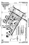 JFK Airport
(2016)
 Richmond Hill
(1873) Richmond Hill Station
(1891) Woodhaven
(1873) Edgemere
(1907) Breezy Point
(n.d.)- Jamaica Bay Unit
(2010)

_-_Geographicus_-_CollegePoint-beers-1873.jpg)


_(14759686276).jpg)


.jpg)


Neighborhoods, neighborhood microcosms – including selected ethnic enclaves
Summarize
Perspective
Because neighborhoods are unincorporated communities, the boundaries and gradations of recognizability vary.
Northwestern Queens
Northeastern Queens
- Bayside
- Bellerose
- College Point
- Douglaston–Little Neck
- Flushing
- Flushing Chinatown
- Auburndale
- Chinatown
- Downtown Flushing
- Kew Gardens Hills
- Linden Hill
- Murray Hill (aka East Flushing)
- Koreatown
- Kissena Corridor Park (on the south border of Murray Hill)
- Willets Point (aka The Iron Triangle)
- Flushing Meadows–Corona Park
- Pomonok
- Floral Park, Queens
- Fresh Meadows
- Glen Oaks
- Whitestone
- Beechhurst
- Clearview
- Malba
Central Queens
- Briarwood
- Corona
- East Elmhurst
- Elmhurst
- Forest Hills
- Forest Hills Gardens (housing development)
- Forest Hills Co-op
-
- Glendale
- Kew Gardens
- Maspeth
- Middle Village
- Juniper Park
- Remsen Cemetery
- Rego Park
- Ridgewood
- Woodside
Southeastern Queens
- Brookville (aka Springfield Gardens)
- Cambria Heights
- Hollis
- Jamaica
- Laurelton
- Meadowmere
- Queens Village
- Rosedale
- St. Albans
- South Jamaica
Southwestern Queens
- The Hole
- Howard Beach
- Hamilton Beach
- Howard Park
- Lindenwood
- Old Howard Beach
- Ramblersville
- Rockwood Park
- Jamaica Bay Wildlife Refuge (south of Howard Beach)
- Ozone Park
- Centreville
- South Ozone Park
- Tudor Village
- Richmond Hill
- Little Pubjab
- Woodhaven
The Rockaways
- Rockaway Peninsula
- Far Rockaway
- Wavecrest
- Bayswater
- Edgemere
- Arverne
- Somerville
- Hammels
- Rockaway Beach
- Seaside
- Rockaway Park
- Belle Harbor
- Neponsit
- Breezy Point
- Roxbury
- Broad Channel (adjacent to the Rockaways)
Remove ads
Bygone Queens communities, community names, and pieces of land
Northwestern Queens
- Astoria
- Astoria Village ★ (Astoria, Queens § Early settlement)
- Hallet's Cove ★ (also spelled Hallett's Cove) (Astoria, Queens § Early settlement)[79]
-
- Jackson Heights
- Trainsmeadow (Trains Meadow) ★
-
- Long Island City
Northeastern Queens
- College Point
- Tew's Neck ★
- Lawrence's Neck ★
- Flammersburg ★
- Strattonport ★
-
- Flushing
- Waldheim ★
- Hinsdale ★
- Flushing Highlands neighborhoods
- Bowne Park ★
- Ingleside ★
- Flushing Park ★
-
- Whitestone
- Beechhurst
- Trow Settlement ★
- Beechhurst
Central Queens
-
- Middelburgh ★ (1652–1664)[82]
- New Towne ★ (1665–1896)
- Steinway ★ (hamlet) (merged in 1870 with Long Island City)
- Bowery Bay ★ (hamlet) (merged in 1870 with Long Island City)
- Middleton ★ (hamlet) (merged in 1870 with Long Island City)
- West Maspeth
- Laurel Hill / West Maspeth
- Berlinville ★ (established 1870s)
- Woodside
- Winfield ★
- Ridgewood
- Middle Village
- Whitepot ★
Southeastern Queens
- Hollis
- Holliswood
- Terrace Heights ★
- Holliswood
- Jamaica
- Springfield[84] ★
- Queens Village
- Creedmoor ★
Southwestern Queens
- Howard Beach
- Ramblersville ★ (1916 became Howard Beach)
-
The Rockaways
- Rockaway, Queens
- Somerville ★ (now called Arverne)
-
- Far Rockaway
- Wave Crest[85] ★
-
––––––––––––––––––––
- The Village of Creedmoor (now part of Queens Village and Glen Oaks), was, essentially, an elaborate, internationally acclaimed rifle range that was, before 1872, part of a farm owned and operated by Bernardus Hendrickson Creed (1811–1889).[86] In July 1872, the State of New York, on behalf of the National Rifle Association of America (NRA), for $26,250 (equivalent to $688,990 in 2024), purchased 70 acres of level land from Creed, and, on June 21, 1873, opened an outdoor firing range with assistance of (i) the U.S. War Department (Army Corps of Engineers), (ii) the State of New York under the auspices of the New York Army National Guard, and (iii) the City of New York. Its name was selected by newspaper man, Col. Henry G. Shaw (né Henry Glenville Shaw; 1843–1907). He initially named it Creed's Moor, a geographical reference, and the name eventually became Creedmoor Rifle Range.[87] The Central Railroad of Long Island – on a line that ran from Long Island City to Bethpage – opened its Creedmoor branch January 8, 1873. Creedmoor's international match, first held in 1874, was the forerunner of the Palma trophy competition. In 1892, as a result of declining public interest and mounting noise complaints from the growing neighborhood, the NRA deeded its land back to the state. In 1908, the State Legislature dedicated the land for use by the Long Island State Hospital.[88] In 1912, the property became the Farm Colony of Brooklyn State Hospital, which eventually became the Creedmoor Psychiatric Center, located south of the interchange of Grand Central and the Cross Island Parkways. (see Google Map aerial view of the Creedmoor Psychiatric Center) After 1960, parts of the property – the Cornell Farmhouse or the Creedmoor Farmhouse Complex or the Jacob Adriance Farmhouse – became part of the Queens County Farm Museum. (see Google Map aerial view of Queens County Farm)[89][90][91][92][93]
- Mussel Island – no occupants ever – was a small and marshy piece of land at the junction of Maspeth Creek and Newtown Creek. (Google Map aerial view the location of the former Mussel Island, at the confluence of Newtown and Maspeth Creeks)
Remove ads
Selected Queens directories not found online
- Boyd, William Andrew (1865). Boyd's Directory of Astoria, East New York, Flatbush, Flushing, Glen Cove, Greenport, Hempstead, Huntington, Jamaica, Newtown, Patchogue, Port Jefferson, Riverhead, Sag Harbor, and Setauket, Long Island – With a Business Directory of Patrons to the Work – And An Appendix of Much General Information, 1864–5. William Andrew Boyd (1850–1818) (publisher) → J.F. Morris & Co. (Joseph F. Morris; born Nov 1853 Rhode Island) (printer). LCCN 18-16812; OCLC 475459351 (all editions).
- Fagan, Patricia Eileen. Transcribed and posted online. Retrieved September 30, 2021. See Fagan's website → "City Directories for Queens"
- Accessible via Family History Center – FHC 1930448.
- Queens Central Library, Jamaica.
- Curtin's Directories. New York, N.Y.: Dennis P. Curtin (publisher). LCCN x18016812; OCLC 1181263688 (all editions).
- Curtin's Directory of Astoria, East New York, Flatbush, Flushing, Glen Cove, Greenport, Hempstead, Huntington, Jamaica, Newtown, Patchogue, Port Jefferson, Riverhead, Sag Harbor, and Setauket, Long Island – With a Business Directory of Patrons of the Work, and an Appendix Containing Important Information, 1865–66. OCLC 80672825, 820330043, 123496599, 83859702, 475935412.
- Curtin's Directory of Astoria, Babylon, Bath, Canarsie, Coldspring, College Point, Cypress Hill, East New York, Farmingdale, Flatbush, Flushing, Glen Cove, Greenpoint, Greenport, Hempstead, Huntington, Islip, Jamaica, Long Island City, Newtown, New Lotts, New Utrecht, Orient, Oyster Bay, Patchogue, Port Jefferson, River Head, Rockaway, Roslyn, Sag Harbor, Southold, Stonybrook and Woodhaven, Long Island. With a Business Directory of Patrons of the Work. 1868–9.
- Curtin's Directory of Astoria, East New York, Flatbush, Flushing, Glen Cove, Greenport, Hempstead, Huntington, Jamaica, Newtown, Patchogue, Port Jefferson, Riverhead, Sag Harbor & Setauket, Long Island – With a Business Directory of Patrons of ... .
- Curtin's Brooklyn Business Directory – Together With General Directory of Amityville, Babylon, Breslau, College Point, East New York, Flatbush, Flushing, Glen Cove, Gravesend, Greenpoint, Hempstead, Huntington, Islip, Jamaica, Long Island City, Newtown, New Utrecht, Oyster Bay, Patchogue, Port Jefferson, Riverhead, Rockaway, Roslyn, Sag Harbor, Sayville, Southold, Stonybrook, Whitestone and Woodhaven, Long Island, 1871–72.
- n.d.: Curtin's Directory of Astoria, East New York, Flatbush, Flushing, Glen Cove, Greenport, Hempstead, Huntington, Jamaica, Newtown, Patchogue, Port Jefferson, Riverhead, Sag Harbor, and Setauket, Long Island – With a Business Directory of Patrons of the Work, and an Appendix Containing Important Information. Dennis P. Curtin. OCLC 475935412.
- Curtin's Brooklyn and Long Island Business Directory for 1877–8 – Includes Brooklyn, and the residents of Amityville, Babylon, Breslan, College Point, East New York, Flatbush, Flushing, Freeport, Glen Cove, Gravesend, Greenport, Hempstead, Huntington, Islip, Jamaica, Long Island City, Northport, Newtown, Oyster Bay, Patchogue, Pearsalls, Port Jefferson, Riverhead, Rockaway, Rockville Centre, Roslyn, Sayville, Southold, Stonybrook, Whitestone, Woodhaven and Woodsburgh. Vol. 13.
- Metropolitan Directory Co.'s Directory of Richmond Hill & Woodhaven, N.Y. – Including Kew Gardens, Forest Hills & Ozone Park – Containing an Alphabetical List of the Residents, Their Occupations & Residences Together With a Classified Business. Metropolitan Directory Co. 1922. OCLC 1066636940.
- Norwood's Guide, First and Second Wards – Queens Best Street Directory – Corona, L.I. City, Woodside, Elmhurst, East Elmhurst, Jackson Heights, Maspeth, Glendale, Ridgewood, Forest Hills, Kew Gardens, Middle Village. Woodside, Queens: C.W. Norwood – Clarence Wesley Norwood (1894–1974). 1931. Queens 1st and 2nd Wards Only, street names old and newLCCN ca31000122; OCLC 1102113843 (all editions).
- Polk's New York City Directory (Boroughs of Queens and Richmond) – Containing an Alphabetical Directory of Business Concerns and Private Citizens, With Wives' First Names Shown [illegible]; A Street and Avenue Guide and Much Information of Miscellaneous Character; Also a Buyerss Guide and Complete Classified Business Directory, 1933–4 (Vol. 1) (NYPL Bar Code No. 3 3433 11990 3692). R.L. Polk & Co., Inc. 1933. → Digitized 2019, The New York Public Library Digital Collections. OCLC 32412222 (all editions); UUID 60eb200-63b3-0137-0e33-6d8cb27f4437.
- Alternate link. January 1933.
{{cite book}}:|work=ignored (help)
- Alternate link. January 1933.
- Robinson's Little Neck–Douglaston Red Book Resident Directory. Hempstead and Mineola, New York: Resident Directory Service, Inc. – Charles Herbert Robinson (1899–1969), President. 1940.
- "For the Year Beginning November, 1940–41" (Vol. 2). 1940.
- "1941–1942" (Vol. 3). 1941.
- Todd, Thomas H. Long Island Star Directory – The Star directory of Long Island City, Embracing Hunter's Point, Blissville, Dutch Kills, Ravenswood, Astoria, Steinway and the German Settlement – Containing Also a Business Directory of the City (Vol. 2). Long Island City: Daily and Weekly Star – Thomas H. Todd & Co. (publisher). LCCN 24-30843; OCLC 480682129 (all editions).
- Todd, Thomas H. (1894). The Star Directory of Long Island City – Embracing a General Directory of the Residents of Hunter's Point, Blissville, Dutch Kills, Ravenswood, Astoria, Steinway and the German Settlement, and North Beach – Also a Classified Business Directory of the Entire City, 1894–1895 (Vol. 3) (476 pages; 12,480 names). Long Island City: Daily and Weekly Star – Thomas H. Todd & Co. (publisher).OCLC 4327124.
- Trow's Business Directory of the Borough of Queens, City of New York. The Trow Directory, Printing & Bookbinding Co. (publisher). LCCN 01-31573; OCLC 987933571.
- Vol. 5 (1902).
- Vol. 7 (1906–1907).
- Vol. 8 (1908–1909).
Remove ads
Bibliography
External links
Wikiwand - on
Seamless Wikipedia browsing. On steroids.
Remove ads