Top Qs
Timeline
Chat
Perspective
Tattinsky District
District in Sakha Republic, Russia From Wikipedia, the free encyclopedia
Remove ads
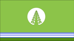
Tattinsky District (Russian: Таттинский улу́с; Yakut: Таатта улууһа, Taatta uluuha) is an administrative[1] and municipal[5] district (raion, or ulus), one of the thirty-four in the Sakha Republic, Russia. It is located in the eastern central part of the republic and borders with Tomponsky District in the north and east, Ust-Maysky District in the south, Churapchinsky District in the southwest, and with Ust-Aldansky District in the northwest. The area of the district is 19,000 square kilometers (7,300 sq mi).[3] Its administrative center is the rural locality (a selo) of Ytyk-Kyuyol.[3] Population: 17,242 (2010 Census);[4] 16,601 (2002 Census);[8] 15,933 (1989 Soviet census).[9] The population of Ytyk-Kyuyol accounts for 39.6% of the district's total population.[4]
Remove ads
Geography
The landscape of the district is mostly flat. Its main rivers include the Amga, the Aldan and the Tatta, a tributary of the latter.
Climate
Average January temperature ranges from −44 to −42 °C (−47 to −44 °F) and average July temperature is +18 °C (64 °F).[2] Annual precipitation is 200–250 millimeters (7.9–9.8 in).[2]
History
The district was established on May 25, 1930.[2] Until 1990, it was called Alexeyevsky (Алексе́евский).[10]
Demographics
As of the 2021 Census, the ethnic composition was as follows:[11]
Economy
The economy of the district is mostly based on agriculture.[2]
Inhabited localities
Divisional source:[12]
Population source:[4]
*Administrative centers are shown in bold
Remove ads
References
Wikiwand - on
Seamless Wikipedia browsing. On steroids.
Remove ads


