Top Qs
Timeline
Chat
Perspective
Ytyk-Kyuyol
Selo in Sakha Republic, Russia From Wikipedia, the free encyclopedia

Remove ads
Ytyk-Kyuyol (Russian: Ытык-Кюёль; Yakut: Ытык-Күөл, romanized: Itık Küöl) is a rural locality (a selo) and the administrative center of Tattinsky District of the Sakha Republic, Russia,[1] located on the left bank of the Tatta River (in the Aldan's basin), 255 kilometers (158 mi) from Yakutsk, the capital of the republic. As of the 2010 Census, its population was 6,828.[2]

.png)
.gif)


Remove ads
Etymology
It is named for a nearby lake, whose name literally means "sacred lake" in the Yakut language. It is one of the few Russian words that begin with Ы.
History
Ytyk-Kyuyol became the administrative center of the newly created Alexeyevsky District in 1930. The district was given its present name (after the Tatta River) in 1990.
Ytyk-Kyuyol is often affected by flooding, most recently on May 20, 2007, when 873 houses were submerged and more than 3,000 people had to be evacuated.
Economy
An agricultural center, Ytyk-Kyuyol has developed cattle and horse breeding industries; growing of potatoes and other vegetables is also common. There is also some timber production.
Ytyk-Kyuyol is located on the R504 Kolyma Highway, allowing road access to Yakutsk.
Demographics
Ethnic Yakuts make up over 95% of the population.
Education
There are two middle-grade schools, a gymnasium, a music school, and a sports school, as well as the literary-artistic museum-reserve "Tatta".
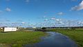
Gallery
 Ytyk-Kyuyol
 Theatre
 Monument
 Monument
 Monument
 Landscape


References
Wikiwand - on
Seamless Wikipedia browsing. On steroids.
Remove ads