Top Qs
Timeline
Chat
Perspective
Thiruvambady
Town in Kerala, India From Wikipedia, the free encyclopedia

Remove ads
Thiruvambady is a major town in Kozhikode district in Kerala, India which lies near foothills of Wayanad. Thiruvambady Assembly constituency is a State Assembly Constituency, situated 35 kilometres (22 mi) from west of Kozhikode.[1]

Remove ads
Geography
Thiruvambady is 35 kilometres (22 mi) towards east from Calicut city and is on the banks of the Iruvanjippuzha River. Thiruvambady is on the footage of Western Ghats and Wyanad forrest which is close to major waterfalls, such as Thusharagiri Falls, Aripara Falls and Kozhippara Waterfalls Kakkadampoyil.
History
Summarize
Perspective
Thiruvambady was established in 1805 (British Rule). Earlier Thiruvambady was a forest area and belonged to East India Company. During that time the land where people settled in Thiruvambady was given to Kottayam King Kalppakassery Karnoru and forest area's domain of land was given to Manniledathu Nair Tharavadu. Old name of Thiruvambady was Nayarukolli and town was situated at Thazhe Thiruvambady. Nair and Exhava people was majority around 1900's. Later in the year 1944, Christians migrated from Pala and Kottayam to this town and settled permanently engaged in agriculture. They built School, Hospital and Church and town relocated to current place. Construction of bridges at Thottathin Kadavu and Agastianmuzhi (Mukkam) gives better access to Thiruvambady. Later a new Bus Stand was built on upper side of Thiruvambady and town gradually moved to current location. As it was Malabar region, Muslims also migrated from other Malabar region to Thiruvambady and engaged in business. Earlier agriculture was the main economy, early from 2000's agricultural economy decline and majority of people engaged in job and business. Due to urban sprawl of Kozhikode city, Thiruvambady became a major town.
Remove ads
Economy
Earlier Thiruvambady was an agricultural town, now due to urban sprawl majority of people engaged in job and business. Still people from hilly area like Anakkampoyil, Kakkadampoyil, Punnackal and Poovaranthodu live on agriculture economy and depends Thiruvambady for their day-to-day life. Many people migrated to overseas as well.
Now Thiruvambady is a major town with all facilities including Schools, Hospitals, Banks, Supermarkets, Hotel, Accommodation, ATM, Fuel Stations, Colleges and shopping centres. There is a Private Bus Station and KSRTC Bus Station with regular access to major towns.
Administration
Thiruvambady Gramapanchayath was established on 1 January 1962 and consists of 17 wards covering an area of 83.96 square kilometres (32.42 sq mi), which includes 9,000 acres (3,600 ha) of forest. Thiruvambady is under Koduvally Block Panchayat and Thamarassery Taluk.
Thiruvambady is part of the Wayanad parliamentary constituency. The current MP is Priyanka Gandhi.
In 1977, the Thiruvambady assembly constituency of the Kerala Legislative Assembly was established, consisting of 7 Panchayats. The current MLA is Linto Joseph.
Remove ads
Transportation
Summarize
Perspective
Road
Thiruvambady is well connected by road to nearby places. State Highway 83 passes through Thiruvambady town. It can be reached by the following routes:
- Thiruvananthapuram - Kochi - Guruvayoor/Thrissur - Pattambi - Perinthalmanna - Manjeri - Areekode - Mukkam - Thiruvambady
- Kozhikode - Kunnamangalam - REC (NIT) - Mukkam (Agastiamuzhi) - Thiruvambady
- Kannur - Koyilandy - Thamarassery - Omassery - Thiruvambady
- Wayanad - Kalpetta - Adivaram - Kaithapoyil - Kodenchery - Thiruvambady
- Nilambur - Akambadam - Kakkadampoyil - Koombara - Koodaranhi - Thiruvambady
- Koduvally - Omassery - Thiruvambady - Pulloorampara - Anakkampoyil
Buses
A KSRTC bus operating centre is in town, as well as a private bus stand. There are buses to nearby places such as Kozhikode, Mukkam, Omassery, Thamarassery, Koduvally, Pulloorampara, Anakkampoyil, Poovaranthode, Koodaranji, and Kodenchery; and KSRTC operates many inter-district routes.
Rail
The nearest railway station is Kozhikode Railway Station, 35 kilometres (22 mi) distant.
Air
The nearest airport is Calicut International Airport, 43 kilometres (27 mi) distant.[2]
There was a proposal to build Thiruvambady International Airport for Calicut City; the plan was later cancelled.[3] Restrictions on larger aircraft landing at the existing airport for safety considerations has been reported as one rationale for building a new airport.[4]
Remove ads
Distance chart
The Kilometer chart from Thiruvambady is given below:
| Kozhikode - 35 km | Thamarassery - 15 km |
| Manjeri - 36 km | Mukkam - 6 km |
| Kunnamangalam - 20 km | Koduvally - 12 km |
| Perinthalmanna - 60 km | Areekode - 20 km |
| Palakkad - 122 km | Omassery - 5 km |
| Thrissur - 133 km | Anakkampoyil - 13 km |
| Ernakulam - 202 km | Koodaranji - 5 km |
| Thiruvananthapuram - 414 km | Kodencheri - 10 km |
| Kannur - 113 km | Pulloorampara - 8 km |
| Kalpetta - 53 km | Kakkadampoyil - 19 km |
| Nilambur - 50 km | Punnackal - 5 km |
| Koyilandy - 43 km | Thusharagiri Falls - 18 km |
Remove ads
Notable people from Thiruvambady
- Mathai Chacko – Late former MLA and communist leader
- Jacob Thoomkuzhy – Former metropolitan archbishop
- Noufal PN footballer
Gallery
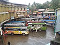 Bus Stand
 Town
Town


References
Wikiwand - on
Seamless Wikipedia browsing. On steroids.
Remove ads