Top Qs
Timeline
Chat
Perspective
Wayne County, Mississippi
County in Mississippi, United States From Wikipedia, the free encyclopedia
Remove ads
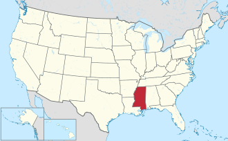
Wayne County is a county located in the U.S. state of Mississippi. As of the 2020 census, the population was 19,779.[1] Its county seat is Waynesboro.[2] The county is named for General Anthony Wayne.
Remove ads
Geography
According to the U.S. Census Bureau, the county has a total area of 814 square miles (2,110 km2), of which 811 square miles (2,100 km2) is land and 2.8 square miles (7.3 km2) (0.3%) is water.[3] It is the fifth-largest county in Mississippi by land area.
Major highways
Adjacent counties
- Clarke County (north)
- Choctaw County, Alabama (northeast)
- Washington County, Alabama (southeast)
- Greene County (south)
- Perry County (southwest)
- Jones County (west)
- Jasper County (northwest)
National protected area
- De Soto National Forest (part)
Remove ads
Demographics
As of the 2020 United States census, there were 19,779 people, 7,683 households, and 5,390 families residing in the county.
Remove ads
Communities
Cities
- Waynesboro (county seat)
Towns
- State Line (mainly located in Greene County)
Census-designated places
Unincorporated communities
- Chicora
- Eret
- Matherville
- Eucutta
- Robinsons Junction (or Robinson's Junction)
Ghost towns
Politics
Summarize
Perspective
Wayne County was originally a Democratic stronghold, but like many parts of Mississippi it swung to the Republican Party beginning in the 1960s. The last Democrat to win the county was Jimmy Carter in 1976, and in 2024 Donald Trump earned the highest share of the votes in the county for a Republican since the lopsided 1972 election.
Remove ads
Education
There are three school districts in the county, Wayne County School District, Wayne Central School District and Waynesboro Riverview School.[12]
The county is in the zone for Jones College.[13]
See also
References
External links
Wikiwand - on
Seamless Wikipedia browsing. On steroids.
Remove ads


