Top Qs
Timeline
Chat
Perspective
Xingshan County
County in Hubei, People's Republic of China From Wikipedia, the free encyclopedia

Remove ads
Xingshan County (simplified Chinese: 兴山县; traditional Chinese: 興山縣; pinyin: Xīngshān Xiàn) is a county of western Hubei, People's Republic of China. It is under the administration of Yichang Prefecture-level City.
.jpg)


Remove ads
Geography
The county occupies the mountainous north-western corner of Yichang prefecture ("prefecture-level city"), bordering on Badong County in the west and Shennongjia in the north. The highest mountains within the county are Mount Wanchao (2,253 metres (7,392 ft) elevation) and Mount Wanfu (1,819 metres (5,968 ft)).
The county seat is in Gaofu town; this is the location that is simply marked as "Xingshan" on less detailed maps.
Although the county is away from the Yangtze River itself, and most of its land is at high elevations, the construction of the Three Gorges Dam resulted in the flooding of the valley of the Yangtze's tributary Xiang Xi (香溪, "Fragrant Stream"), where many of the county's residents lived. Accordingly, some 20,000 residents had to be relocated from the flooded areas.[3] It is officially part of the Three Gorges Reservoir Region.
Remove ads
Climate
Remove ads
Administrative division
The county is administratively divided into 8 township-level divisions: 6 towns and 2 townships.[1][6][7]
Six towns:
Two townships:
Gallery
 Baishahe Village, Nanyang Town
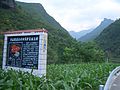 In Liangtai River valley, near Gaoqiao Township
 Houzibao Hydroelectric Power Station
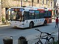 Regular bus service operates between the county seat (Gufu) and other major towns


Notes
External links
Wikiwand - on
Seamless Wikipedia browsing. On steroids.
Remove ads