Loading AI tools
River From Wikipedia, the free encyclopedia
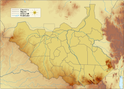
The Yabus River (or Khor Yabus) rises in the far west of Ethiopia, in Asosa Zone, flows west into Sudan past the town of Yabus, then enters South Sudan.[2] At the town of Bunj it turns south west and enters the Machar Marshes,[3] where it loses its identity.
Yabus River Khor Yabus | |
---|---|
Location | |
Country | South Sudan, Sudan, Ethiopia |
Physical characteristics | |
Source | |
• coordinates | 9.480521°N 34.462993°E |
• elevation | 1,346 m (4,416 ft) |
Mouth | Machar Marshes |
• coordinates | 9°52′N 33°35′E |
• elevation | 432 m (1,417 ft) |
Length | 192 km (119 mi) |
Basin size | 6,080 km2 (2,350 sq mi) |
Discharge | |
• location | Mouth (estimate) [1] |
• average | 34.57 m3/s (1,221 cu ft/s) |
• minimum | 3.61 m3/s (127 cu ft/s) |
• maximum | 103.82 m3/s (3,666 cu ft/s) |
Basin features | |
Progression | Machar Marshes → Adar → White Nile → Nile → Mediterranean Sea |
River system | Nile Basin |
Cities | Bunj |
Population | 227,000 |
The river is sometimes confused with the Dabus River, a tributary of the Blue Nile, also known as the Yabus River. The sources of the two rivers are close to each other.
Seamless Wikipedia browsing. On steroids.
Every time you click a link to Wikipedia, Wiktionary or Wikiquote in your browser's search results, it will show the modern Wikiwand interface.
Wikiwand extension is a five stars, simple, with minimum permission required to keep your browsing private, safe and transparent.