അയർലന്റ്
From Wikipedia, the free encyclopedia
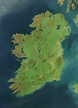
പശ്ചിമ യൂറോപ്പിൽ വടക്കൻ അറ്റ്ലാന്റിക് സമുദ്രത്തിൽ 84,421 ച.കി.മീ. വിസ്തൃതിയിൽ കിടക്കുന്ന ദ്വീപാണ് അയർലന്റ്. നോർത്ത് ചാനൽ, ഐറിഷ് കടൽ, സെന്റ് ജോർജ്ജ് ചാനൽ, കെൽട്ടിക് കടൽ എന്നിവ വടക്കു മുതൽ തെക്കു വരെ (ഘടികാരദിശയിൽ) അതിരിടുന്നു. അയർലന്റിനു കിഴക്കായാണ് പ്രധാന ബ്രിട്ടീഷ് ദ്വീപായ ഗ്രേറ്റ് ബ്രിട്ടൻ സ്ഥിതി ചെയ്യുന്നത്. അയർലന്റ് ദ്വീപ് എയ്റ എന്നാണ് ഐറിഷ് ഭാഷയിൽ അറിയപ്പെടുന്നത്. ഹരിതാഭമായ ഭൂപ്രകൃതി കാരണം മരതകദ്വീപ് എന്നൊരു ചെല്ലപ്പേരുണ്ട്.
| |
|---|---|
 Satellite image, October 2010 | |
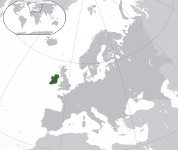
 Location of Ireland (dark green) on the European continent (dark grey) | |
| Geography | |
| Location | Northwestern Europe |
| Coordinates | 53°25′N 8°0′W |
| Adjacent bodies of water | Atlantic Ocean |
| Area | 84,421 km2 (32,595 sq mi)[1] |
| Area rank | 20th[2] |
| Coastline | 7,527 km (4,677.1 mi)[3][4] |
| Highest elevation | 1,041 m (3,415 ft) |
| Highest point | Carrauntoohil |
| Administration | |
| Largest city | Dublin (pop. 1,173,179) |
| Country | Northern Ireland |
| Largest city | Belfast (pop. 343,542) |
| Demographics | |
| Demonym | Irish |
| Population | 7,026,636 (2022)[a][5] |
| Population rank | 19th |
| Pop. density | 77.8 /km2 (201.5 /sq mi) |
| Languages | |
| Ethnic groups | |
| Additional information | |
| Time zone |
|
| • Summer (DST) |
|
| Patron saints | Saint Patrick Saint Brigid Saint Colmcille |
| |
അയർലന്റ് ദ്വീപിലെ ആറിൽ അഞ്ച് ഭാഗത്തോളം വരുന്ന തെക്കൻ മേഖലയാണ് റിപ്പബ്ലിക്ക് ഓഫ് അയർലണ്ട് എന്ന രാജ്യം. അവശേഷിച്ച വടക്കൻ മേഖല ഉത്തര അയർലന്റ് എന്ന പേരിൽ ബ്രിട്ടന്റെ ഭാഗമാണ്.
അവലംബം
Wikiwand in your browser!
Seamless Wikipedia browsing. On steroids.
Every time you click a link to Wikipedia, Wiktionary or Wikiquote in your browser's search results, it will show the modern Wikiwand interface.
Wikiwand extension is a five stars, simple, with minimum permission required to keep your browsing private, safe and transparent.
