Bedfordshire
County of England / From Wikipedia, the free encyclopedia
Dear Wikiwand AI, let's keep it short by simply answering these key questions:
Can you list the top facts and stats about Bedfordshire?
Summarize this article for a 10 year old
Bedfordshire (/ˈbɛdfərdʃɪər, -ʃər/; abbreviated Beds) is a ceremonial county in the East of England. It is bordered by Northamptonshire to the north, Cambridgeshire to the north-east, Hertfordshire to the south and the south-east, and Buckinghamshire to the west. The largest settlement is Luton (225,262),[3][not verified in body] and Bedford is the county town.[4]
Bedfordshire | |
|---|---|
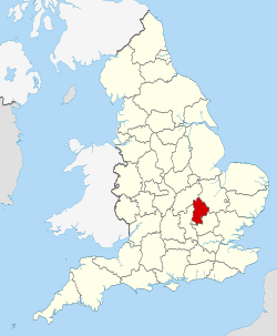
 Location of Bedfordshire in England | |
| Coordinates: 52°05′N 0°25′W | |
| Sovereign state | United Kingdom |
| Constituent country | England |
| Region | East |
| Established | Ancient |
| Time zone | UTC+0 (GMT) |
| • Summer (DST) | UTC+1 (BST) |
| UK Parliament | List of MPs |
| Police | Bedfordshire Police |
| Largest town | Luton |
| Ceremonial county | |
| Lord Lieutenant | Susan Lousada |
| High Sheriff | Russel Beard (2023-24) |
| Area | 1,235 km2 (477 sq mi) |
| • Rank | 41st of 48 |
| Population (2022)[1] | 715,940 |
| • Rank | 36th of 48 |
| Density | 580/km2 (1,500/sq mi) |
| Ethnicity | 72.0% White 16.6%. Asian 5.6% Black Mixed 3.8% 1.9% Other[2] |
| Districts | |
 Districts of Bedfordshire Unitary | |
| Districts | |
The county has an area of 1,235 km2 (477 sq mi) and had a population of 704,736 at the 2021 census.[2] Its other towns include Leighton Buzzard, Dunstable, Biggleswade, Houghton Regis, and Flitwick. Much of the county is rural. For local government purposes, Bedfordshire comprises three unitary authority areas: Bedford, Central Bedfordshire, and Luton.
The county's highest point is 243 m (797 ft) on Dunstable Downs in the Chilterns.[5]


