Top Qs
Timeline
Chat
Perspective
Electoral district of Morayfield
State electoral district of Queensland, Australia From Wikipedia, the free encyclopedia
Remove ads
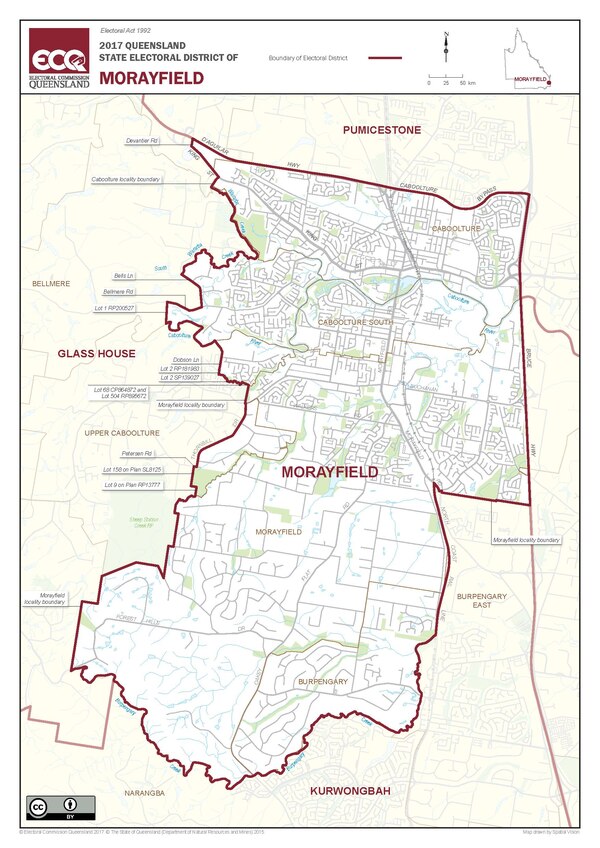
Morayfield is an electoral district of the Legislative Assembly in the Australian state of Queensland. It is located in the northern outskirts of Brisbane, south of the Sunshine Coast.[1]

Remove ads
Geography
An outer suburban electorate, Morayfield lies west of the Bruce Highway and south of the Caboolture River. The northern end of the district takes in the suburb of Morayfield and the southern part of Caboolture. At its southern end, the district includes parts of the suburbs of Burpengary and Narangba.
History
A new district created for the 2009 state election, it was constructed mostly from the northern part of the district of Kallangur and the western part of the district of Pumicestone. It also took a section of territory previously belonging to the district of Kurwongbah.[2] Its inaugural member was Mark Ryan of the Labor Party, who was defeated by Darren Grimwade of the Liberal National Party in 2012.
Remove ads
Members for Morayfield
Election results
This graph was using the legacy Graph extension, which is no longer supported. It needs to be converted to the new Chart extension. |
Primary vote results in Morayfield (Parties that have never gotten 5% of the vote are omitted)
Labor
Liberal National
One Nation
Greens
Katter's Australian
Palmer United
Independent
This graph was using the legacy Graph extension, which is no longer supported. It needs to be converted to the new Chart extension. |
Two-candidate-preferred vote results in Morayfield
Remove ads
References
External links
Wikiwand - on
Seamless Wikipedia browsing. On steroids.
Remove ads


