Top Qs
Timeline
Chat
Perspective
Onsu County
County in Xinjiang, China From Wikipedia, the free encyclopedia

Remove ads
Onsu County[2][3][4][5][6] (Uyghur: ئونسۇ ناھىيىسى, romanized: Onsu Nahiyisi[7]) and from Mandarin Chinese Wensu County (Chinese: 温宿县), is a county in the Xinjiang Uygur Autonomous Region and is under the administration of the Aksu Prefecture, bordering Kyrgyzstan's Issyk-Kul Region to the northwest. It contains an area of 14,309 km2 (5,525 sq mi).
.png)


Remove ads
Etymology
The toponym Wensu (温宿) had appeared in historical records of the Western Han Dynasty as one of the 36 states in the Western Regions.[8][9] The name 'Onsu' (Wensu) means "ten rivers" in Uyghur and other Turkic languages.[10] The name is similar to that of the nearby Zhetysu region which means "seven rivers"- both names consist of a number followed by 'su' (river; water).[11] The name Aksu is Turkic for 'white water'.[12]
In Uyghur, the county is called Aksu Konaxahar (阿克苏阔纳协海尔) meaning 'the old city of Aksu'.[13]
Remove ads
History
Onsu County was established in 1902.[14]
On May 29, 1958, Onsu County was eliminated and its territory made part of Aksu County. In 1962, Onsu County was restored.[15]
In a Radio Free Asia interview, a Han Chinese staffer in the Onsu County local government said that in July 2017, a policy to affix QR codes to all knives belonging to Uyghurs was being carried out.[16]
As of March 2018, every cadre in the county was required to spend eight days a month at the home of villagers.[17]
In the late 2010s, Onsu County was the site of vocational education and training centers (also understood as deradicalization centers, re-education camps or concentration camps).[18][19] According to a Radio Free Asia interview with an officer at the Onsu county police station, as of August 2018, 30,000 persons, or about one in six Uyghurs in the county (approximately 16% of the overall population of the county), were detained in re-education camps.[2]
Remove ads
Administrative divisions
Summarize
Perspective
Onsu County administered 8 towns, 4 townships, and 1 ethnic township.[20][21]
Climate
Remove ads
Economy
Agricultural products include rice, wheat, corn, cotton and fruit products. Sheep wool and sheepskins are produced in abundance. Industries produce food, spun cotton, building materials and coal.[14]
As of 1885[update], there was about 139,200 acres (919,475 mu) of cultivated land in Onsu.[30]
Demographics
As of 2015, 197,360 of the 259,305 residents of the county were Uyghur, 55,335 were Han Chinese and 6,610 were from other ethnic groups.[31]
According to the 2002 census, it has a population of 210,000.[citation needed]
As of 1999, 76.17% of the population of Onsu (Wensu) County was Uyghur and 21.43% of the population was Han Chinese.[32]
Remove ads
Transportation
Historical maps
Historical English-language maps including Onsu:
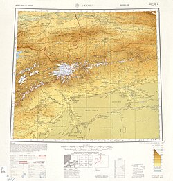 Map including Uqturpan (labeled as WEN-SU (AKSU-KONE SHAHR)) and surrounding region from the International Map of the World (AMS, 1950)[b]
 Map including Onsu (labeled as WENSU) (DMA, 1981)
_-_panoramio.jpg)


Notes
- Locals in Xinjiang frequently observe UTC+6 (Xinjiang Time), 2 hours behind Beijing.
References
Wikiwand - on
Seamless Wikipedia browsing. On steroids.
Remove ads