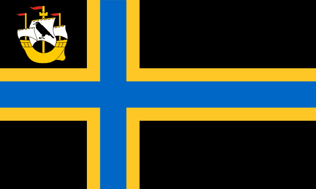
Caithness
Historic county in northern Scotland / From Wikipedia, the free encyclopedia
Dear Wikiwand AI, let's keep it short by simply answering these key questions:
Can you list the top facts and stats about Caithness?
Summarize this article for a 10 year old
Caithness (Scottish Gaelic: Gallaibh [ˈkal̪ˠɪv]; Old Norse: Katanes[1]) is a historic county, registration county and lieutenancy area of Scotland.
Caithness
| |
|---|---|
 | |
| Coordinates: 58°25′N 3°30′W | |
| Sovereign state | |
| Country | |
| Council area | Highland |
| County town | Wick |
| Area | |
| • Total | 618 sq mi (1,601 km2) |
| Ranked 14th of 34 | |
| Demonym | Caithnesian |
| Chapman code | CAI |
Caithness has a land boundary with the historic county of Sutherland to the west and is otherwise bounded by sea. The land boundary follows a watershed and is crossed by two roads (the A9 and the A836) and by one railway (the Far North Line). Across the Pentland Firth, ferries link Caithness with Orkney, and Caithness also has an airport at Wick. The Pentland Firth island of Stroma is within Caithness.
The name was also used for the earldom of Caithness (c. 1334 onwards) and for the Caithness constituency of the Parliament of the United Kingdom (1708 to 1918). Boundaries are not identical in all contexts, but the Caithness area as of 2019[update] lies entirely within the Highland council area. Until its demise in the 15th century, the Norn language was the common language of everyday communication for people in Caithness, before being gradually overtaken by Scots (and later, English).[2]
