Cumbria
Ceremonial county of England / From Wikipedia, the free encyclopedia
Dear Wikiwand AI, let's keep it short by simply answering these key questions:
Can you list the top facts and stats about Cumbria?
Summarize this article for a 10 year old
Cumbria (/ˈkʌmbriə/ KUM-bree-ə) is a ceremonial county in North West England. It borders the Scottish council areas of Dumfries and Galloway and Scottish Borders to the north, Northumberland and County Durham to the east, North Yorkshire to the south-east, Lancashire to the south, and the Irish Sea to the west. Its largest settlement is the city of Carlisle.
This article's lead section contains information that is not included elsewhere in the article. (April 2024) |
Cumbria | |
|---|---|
 Location of Cumbria within England | |
| Coordinates: 54°30′N 3°15′W | |
| Sovereign state | United Kingdom |
| Constituent country | England |
| Region | North West England |
| Established | 1 April 1974 |
| Established by | Local Government Act 1972 |
| Time zone | UTC+0 (GMT) |
| • Summer (DST) | UTC+1 (BST) |
| UK Parliament | 6 MPs |
| Police | Cumbria Constabulary |
| Largest city | Carlisle |
| Ceremonial county | |
| Lord Lieutenant | Alexander Scott[1] |
| High Sheriff | Samantha Scott[2] |
| Area | 6,768 km2 (2,613 sq mi) |
| • Rank | 3rd of 48 |
| Population (2022)[3] | 503,033 |
| • Rank | 42nd of 48 |
| Density | 74/km2 (190/sq mi) |
| Ethnicity | |
| Districts | |
 Districts of Cumbria Unitary | |
| Districts | |
The county is predominantly rural, with an area of 6,769 km2 (2,614 sq mi) and a population of 500,012; this makes it the third largest ceremonial county in England by area but the eighth-smallest by population. After Carlisle (74,281), the largest settlements are Barrow-in-Furness (56,745), Kendal (29,593), and Whitehaven (23,986). For local government purposes the county comprises two unitary authority areas, Westmorland and Furness and Cumberland.[5] Cumbria was created in 1974 from the historic counties of Cumberland and Westmorland, the Furness area of Lancashire, and a small part of Yorkshire.
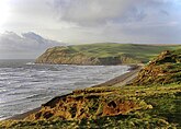
The interior of Cumbria contains large upland areas. The south-west contains the Lake District, a national park and UNESCO world heritage site which includes Scafell Pike, England's highest mountain,[6] and Windermere, its longest and largest lake. The Border Moors and North Pennines lie along the county's eastern border. The south-east contains the Orton Fells, Howgill Fells and part of the Yorkshire Dales, which are all within the Yorkshire Dales national park.[7] The Vale of Eden, the valley of the River Eden, runs south-east to north-west between these upland areas, and broadens into the Solway Plain near Carlisle.[8][9] The county has long coast to the west, which is bordered by a plain for most of its length. In the north-west it borders the Solway Firth, a national landscape, and to the south are the Cartmel and Furness peninsulas. East of the peninsulas, the county contains part of Arnside and Silverdale, also a national landscape.
The county contains several Neolithic monuments, such as Mayburgh Henge. The region was on the border of Roman Britain, and Hadrian's Wall runs through the north of the county. In the Early Middle Ages parts of the region successively belonged to Rheged, Northumbria, and Strathclyde, and there was also a Viking presence. It became the border between England and Scotland, and was unsettled until the Union of the Crowns in 1603. During the Industrial Revolution mining took place on the Cumberland coalfield and Barrow-in-Furness became a shipbuilding centre, but the county was not heavily industrialised and the Lake District became valued for its sublime and picturesque qualities, notably by the Lake Poets.


