Top Qs
Timeline
Chat
Perspective
Hotan Prefecture
Prefecture of Xinjiang, China From Wikipedia, the free encyclopedia

Remove ads
Hotan Prefecture[10] (see also § Etymology) is located in the Tarim Basin region of southwestern Xinjiang, China, bordering the Tibet Autonomous Region to the south and Union Territory of Ladakh and Gilgit-Baltistan to the west. The vast majority of the Aksai Chin region which is disputed between China and India is administered as part of Hotan Prefecture. The seat of Hotan Prefecture is Hotan and its largest county by population is Karakax County. The vast majority of the residents of the prefecture are Muslim Uyghurs and live around oases situated between the desolate Taklamakan Desert and Kunlun Mountains.

The region was the center of the ancient Iranian Saka Buddhist Kingdom of Khotan. Later, the region was part of the Kara-Khanid Khanate, followed by the Qara Khitai, Chagatai Khanate, Moghulistan and the Dzungar Khanate, which was conquered by the Qing dynasty of China. Hotan became part of Xinjiang under Qing rule.[11] In the 1930s, the Khotan Emirate declared independence from China.[citation needed] The People's Liberation Army entered Hotan in 1949.
The prefecture is known for its jade, silk and carpets.
Remove ads
Etymology
Hotan Prefecture is named for its seat, Hotan (or Khotan). The area was originally known as Godana in ancient Sanskrit cosmological texts.[12] The Chinese transcribed the name as 于窴, pronounced Gudana in Middle Chinese (Yutian in modern Standard Chinese); the pronunciation eventually morphed into Khotan. In the 7th century, the Chinese Buddhist monk and scholar Xuanzang attempted to remedy this lexical change. Xuanzang, who was well-versed in Sanskrit, proposed that the traditional name was in fact Kustana (गौस्तन) and asserted it meant "breast of the Earth". However, this was likely borrowed from the Tibetan name for the region, Gosthana, which means "land of cows". It is therefore most likely that the original name of Hotan was Sanskritic in origin, a consequence of ancient Indian settlement in the area.[13][14]
The official Uyghur-Latin transliteration, and therefore English spelling, of the modern city's name is "Hotan" according to the Register of Chinese Geographic Places.[15] The Hanyu pinyin romanization Hetian has also been used on some maps.
Remove ads
History
Summarize
Perspective
The Hotan Prefecture region played a major part in the Dungan Revolt (1862–1877).[11]
Tunganistan was an independent administered region in the southern part of Xinjiang from 1934 to 1937. The territory included the oases of the southern Tarim Basin; the centre of the region was Khotan.
On 22 December 1949, PLA forces reached Hotan. In 1950, the area was redesignated as Hotan District (和闐專區).[16]
In 1959, the Chinese character name of Hotan was changed from '和阗' to the homophonous '和田'.[1][16]
In 1962, events of the Sino-Indian War occurred in parts of Aksai Chin administered as part of Hotan Prefecture.
In 1971, Hotan was changed from a district (专区) to a prefecture (地区).[16]
Between June 1991 and March 1992, there were six attacks with firearms on Han Chinese residents in Hotan Prefecture.[17]
According to a reporter for the Wen Wei Po in Ürümqi, between January and August 2005, authorities had disbanded six "illegal underground" religious schools in Hotan Prefecture and confiscated more than one hundred unauthorized religious books and periodicals as well as 972 audio and video tapes.[18][19]
In 2016, Kunyu was established within the boundaries of Hotan Prefecture.
In 2020 during the COVID-19 pandemic in mainland China, 171 Uyghur workers from Hotan Prefecture were sent to Changsha, Hunan.[20]
Remove ads
Geography
The vast majority of the residents live around oases situated between the desolate Taklamakan Desert and Kunlun Mountains. To the north, the prefecture borders Aksu Prefecture, to the east Bayingolin Mongol Autonomous Prefecture, to the west Kashgar Prefecture, and to the south, Tibet and the areas disputed between China, India and Pakistan. Aksai Chin includes the southernmost point administered as part of Xinjiang. Most of the prefecture has a cold desert climate.
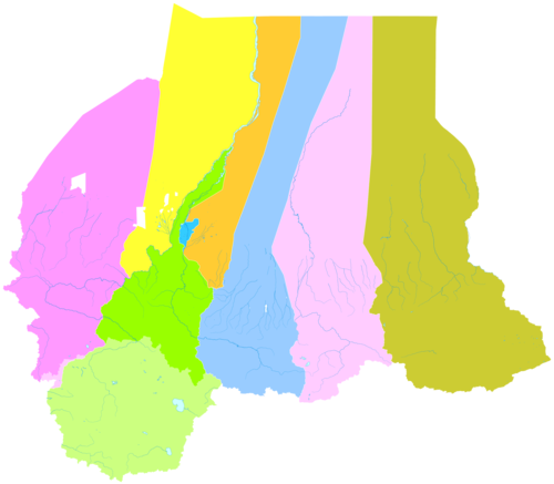
Administrative divisions
Summarize
Perspective
のポプラ防風林_36556483052_35ae0e8819_o.jpg)

The Hotan Prefecture is divided into one county-level city and seven counties and surrounds Kunyu:[21][2]

Remove ads
Demographics
As of 2015, 2,248,113 (96.7%) of the 2,324,287 residents of the prefecture were Uyghur, 71,233 were Han Chinese (3.1%) and 4,941 were from other ethnic groups.[23]
In 2014, according to a local government employee in the township of Langru in Hotan County, "Islamic beliefs are very strong" in the prefecture.[7]
As of the 2000s, the population of Hotan Prefecture was more than 95% Uyghur.[5][6][7][8]: 178
As of 1999, 96.9% of the population of Hotan (Hetian) Prefecture was Uyghur and 3.1% of the population was Han Chinese.[24]
Residents of Hotan Prefecture commonly speak Uyghur and often do not speak Mandarin Chinese.[8]: 181 [25][26][27]: 241 [better source needed]
Remove ads
Notable persons
- Ismail Amat, former Chairman (Governor) of Xinjiang
- Islam Akhun, con-man
- Juma Tayir, imam of the Id Kah Mosque, murdered by ETIM terrorists
- Kurban Tulum, Member of the Fourth National People's Congress, a symbol of unity between Han people and the Uyghurs
- Ablajan Awut Ayup, a pop singer, songwriter and dancer
- Abdul Haq al-Turkistani, militant
Historical maps
Historical English-language maps including modern-day Hotan Prefecture area:
 Map including ILCHÍ (1865)
 Map of the expeditions of Sven Hedin (1906-8) including the southern part of the modern Hotan Prefecture (RGS, early 20th century)
 Map including Hotan (labeled as Khotan) (1917)


_p61_PLATE19._SINKIANG_(14597194848).jpg)


Remove ads
Notes
- includes areas in Aksai Chin
- includes areas in Aksai Chin
- From map: "DELINEATION OF INTERNATIONAL BOUNDARIES MUST NOT BE CONSIDERED AUTHORITATIVE".
- From map: "The representation of international boundaries is not necessarily authoritative."
- From map: "The representation of international boundaries is not necessarily authoritative"
- From map: "The representation of boundaries is not necessarily authoritative."
- From map: "The representation of boundaries is not necessarily authoritative."
Remove ads
Footnotes
External links
Wikiwand - on
Seamless Wikipedia browsing. On steroids.
Remove ads