Top Qs
Timeline
Chat
Perspective
Kashgar Prefecture
Prefecture of Xinjiang, China From Wikipedia, the free encyclopedia
Remove ads
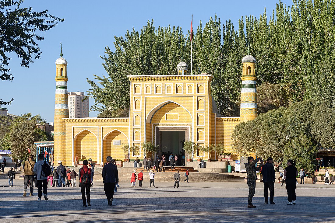
Kashgar Prefecture,[3][4][5][6] also known as Kashi Prefecture,[7][8] is a prefecture located in southwestern Xinjiang, China, located in the Tarim Basin region (roughly the southern half of Xinjiang). It has an area of 112,057 km2 (43,265 sq mi) and 4,496,377 inhabitants at the 2020 census[9] with a population density of 35.5 inhabitants/km2. The capital of the prefecture is the city of Kashgar which has a population 506,640.[10]
Kashgar Prefecture borders the Gorno-Badakhshan Autonomous Region of Tajikistan, Badakhshan Province of Afghanistan, Gilgit-Baltistan of Pakistan, and Ladakh of India in the far south.
Remove ads
History
Summarize
Perspective
Kashgar, formerly referred to as Shule, served as the capital of the Shule Kingdom in the 2nd century B.C.,[11] inhabited by Indo-European tribes speaking Ancient Tocharian languages in the Tarim Basin.[12] The earliest references to Shule emerged in the literature of the Han Dynasty. Shule served as the pivotal junction of the Silk Road in the northern Tarim Basin, facilitating access to the Dayuezhi, Dayuan, and Kangju in Central Asia, and acting as the nexus of east–west communication.[13] Circa 177 B.C., Shule faced oppression by the advancing Dayuezhi and was compelled to ally with the formidable Xiongnu, becoming one of its 36 vassal states.[14]
After the Communist takeover of Kuomintang, Kashgar Prefecture (喀什專區) and Yarkant Prefecture (莎車專區) were established.
In 1902, a magnitude 7.7 earthquake struck the prefecture.[15] It caused extreme devastation, destroying 30,000 homes and killing as many as 10,000 people.[16]
In 1942, Xinjiang restructured Shache, Zephyr, and Maigaiti counties, amalgamating them with Yecheng County in the Hotan district to establish the 10th administrative district of Xinjiang (Shache district), which encompasses Shache, Zephyr, Makgaiti, and Yecheng counties. In 1949, the Kashi subdistrict was established in Xinjiang, which was part of Xinjiang province.[17]
In 1955, Barin, Jamaterek and Ujme, which were part of Yengisar County, became part of Akto County and Bulungkol was transferred to Akto County in Kizilsu from Tashkurgan County in today's Kashgar Prefecture.[18] In June 1956, Yarkant Prefecture was dissolved and made part of Kashgar Prefecture.[19][20] On January 11, 1971, Kashgar Prefecture was designated as Kashgar Region.[21]
In January 1979, Kashgar zhuānqū Prefecture (喀什专区) became Kashgar dìqū Prefecture (喀什地区).[19]
In August 1982, Kashgar Prefecture opened a frontier post to exchange goods with Pakistan.[5]: 223 Kashgar was recognized as a National Famous Historical and Cultural City of China in 1986.[22] In May 2010, the Central Xinjiang Work Conference formally sanctioned the creation of a Special Economic Zone (SEZ) in Kashgar, designating it as China's sixth SEZ,[23] which benefits from preferential policies in industry, taxation, finance, land, and foreign commerce.[24][25]
In February 2002, a 6.7 magnitude earthquake killed 267 people in Maralbexi County and Payzawat County.[26]
Remove ads
Geography
Most of the prefecture has a cold desert climate.
The second-highest peak on Earth, K2, is located on the China–Pakistan border in southern Kashgar Prefecture[27] in an area claimed by India as part of the Trans-Karakoram Tract.
Administrative divisions
Demographics
Summarize
Perspective
As of the end of 2017, 4,295,200 of the 4,649,700 residents of the prefecture were Uyghur, 288,000 were Han Chinese and 66,500 were from other ethnic groups.[30]
The population of Kashgar Prefecture was 4,499,158 according to the 2015 census. It has a population density of 35.5 inhabitants per km2.[31]
As of 2015, 4,140,255 of the 4,499,158 residents of the prefecture were Uyghur, 292,972 were Han Chinese and 65,931 were from other ethnic groups.[32]
As of 1999, 89.37% of the population of Kashgar (Kasi) Prefecture was Uyghur and 9.1% of the population was Han Chinese.[33]
In 1997, the population of Kashgar Prefecture was 3,145,000 with Uyghurs making up 89.4% of the total.[19]
As of 1983–4, Kashgar Prefecture had 6,180 mosques. In the mid-1980's, there were two million Uyghurs in Kashgar Prefecture and 360,000 Han Chinese.[5]: 224
- Population by ethnicity
Remove ads
Economy
In early 2010, the National Development and Reform Commission released a Circular regarding the Progress of Western Development in 2009 and Work Arrangements for 2010, announcing the promotion of Dongxing in Guangxi, Ruili in Yunnan, the Kashgar region in Xinjiang, and Manzhouli in Inner Mongolia as Special Economic Zones (SEZs) along the borders in 2010.[36] A conference regarding Xinjiang's developments was held in Beijing in May 2010, coinciding with the establishment of the Kashgar Special Economic Zone, which pioneered reforms in resource taxation and fees in Xinjiang. The region's per capita GDP attained the national average within five years.[37][38]
Remove ads
Historical maps
Historical English-language maps including modern-day Kashgar Prefecture area:
- Map including Kashgar (1917)
- "Territory ceded by Pakistan to China in 1963 and never recognized by India" (Trans-Karakoram Tract in southern Kashgar Prefecture)
Remove ads
See also
Notes
References
External links
Wikiwand - on
Seamless Wikipedia browsing. On steroids.
Remove ads


