Արալի ծով
From Wikipedia, the free encyclopedia
From Wikipedia, the free encyclopedia
Արալյան ծով (Արալ, ղազ.՝ Арал теңізі, ուզբ.՝ Orol dengizi, Օռոլ դենգիզի, - նախկին անհոսք աղի լիճ Միջին Ասիայում, Ղազախստանի և Ուզբեկստանին սահմանին։ 1960-ից ծովի մակարդակը և նրանում ջրի քանակը սկսեց շատ արագ նվազել, նրա մեջ թափվող Ամուդարյա և Սիրդարյա գետերի ջուրը ոռոգման նպատակով օգտագործելու հետևանքով։ 1989-ին վերածվեց երկու առանձին ջրամբարների՝ Հյուսիսային (Փոքր) և Հարավային (Մեծ) Արալյան ծովերի։ 2014 թվականին Հարավային (Մեծ) Արալյան ծովի արևելյան մասը ամբողջովին չորացավ, այդ տարի հասնելով լճի մակերեսի պատմական նվազագույնին, շուրջ 7297 կմ²։ 2015 թվականի գարնանը լիճը ժամանակավոր լցվեց, ամբողջ լճի մինչև 10780 կմ²։ 2015 թվականի աշնանը հայելու մակերեսը կրկին փոքրացավ, հասնելով մինչև 8303 կմ²[1][2]. Մինչև ցամաքելը Արալյան ծովը չորրորդ ամենամեծ լիճն էր աշխարհում[3]։

 kk/Арал теңізі/uz/Orol dengizi, Орол денгизи/kaa/Aral ten'izi, Арал теңизи | ||
 | ||
| Կոորդինատներ | ||
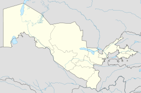
| Տեղագրություն | Միջին Ասիա | |
| Երկիր | Ղազախստան/Ուզբեկստան | |
| Ծավալը | մինչև 1500—2000 կմ³ | |
| Աղիությունը | 51-52 ‰ | |
| Թափվող գետերը | Սիրդարյա/Ամուդարյա | |
 | ||
 | ||
Արալյան ծովը հայտնաբերվել է, ռադիոածխածնային մեթոդի բացարձակ ազդանշանի օգնությամբ, շուրջ 20-24 հազար տարի առաջ[4]։ Պատմական դարաշրջանում Արալյան ծովի մակարդակի զգալի տատանումներ են տեղի ունեցել։ Այսպիսով, լճի հատակի չորացած հատվածում հայտնաբերվել են այս վայրում աճող ծառերի մնացորդներ։ Որոշ գնահատականների համաձայն, ավելի վաղ Ամուդարիան Ուզբոյ գետաբազուկով թափվել է Կասպից ծով, իսկ Տուրգայը՝ Արալ[5][6][7]։ Թուրքական լեզվով «արալ» նշանակում է « կղզի, կղզեխումբ »[8]։ 16-րդ դարի վերջին և 17-րդ դարի սկզբին ջրի մակարդակի իջեցման պատճառով ձևավորվեցին Բարսակելմես, Կասկակուլան, Կոզժետպես, Ույալի, Բիյիկտաու, Վերածննդի կղզիները։ Սիրդարյաի գետաբազուկներ Ժանադարյան և Կուանդարյան 1819 և 1823 թվականներից համապատասխանաբար սկսվեցին չթափվել Արալյան լիճ։

1849 թվականին Ալեքսեյ Իվանովիչ Բուտակովի ղեկավարությամբ, անցկացվեց Արալյան ծովը նկարագրելու առաջին գիտական արշավը։ Անցկացվեց նաև Արալյան ծովի ընդհանուր հետախուզում, չափվեց խորությունը, կատարվեց Բարսա-Կելմես կղզու ամբողջական լուսանկարը, հայտնագործվեց և ուսումնասիրվեց Վերածննդի կղզիները, անցկացվեց աստղադիտական և օդերևութաբանական ուսումնասիրություններ, ձմռանը սառցային ժամանակաշրջանի բնութագիրը, ստեղծվեց օգտակար հանածոների հավաքածու։
Արալյան ծովի հետագա հետախուզումը տեղի ունեցավ միաժամանակ Կենտրոնական Ասիայի երկրների անդամակցության ռազմական գործողությունների հետ ու նրանց մեջ մասնակցում էր Արալյան ծովի նավատորմիկը։

Միջին Ասիայում 1930-ական թվականներին սկսվեց ոռոգման ջրանցքների լայնածավալ շինարարությունը, որը ակտիվացավ հատկապես 1960-ականների սկզբին։ 1961 թվականից ծովը սկսեց խիստ ծանծաղել։ Ծանծաղելու պատճառներից մեկը ոռոգման նպատակով նրա մեջ թափվող գետերի ջրի օգտագործումն էր։ 1960 թվականից 1990 թվականը Կենտրոնական Ասիայում ոռոգվող տարածքի տարածքը 4,5 միլիոնից աճեց մինչև 7 միլիոն հեկտար։ Տարածաշրջանում տնտեսության ջրի պահանջարկը տարեկան 60 կմ³-ից աճեց մինչեւ 120 կմ³, որից 90 %-ը ոռոգման, միևնույն ժամանակ այն ջուրը, որը նախատեսված էր ոռոգման համար, հաճախ օգտագործվեց անարդյունավետ։ Սկսած 1961 թվականից ծովի մակարդակը նվազեց է 20-ից մինչև 80-90 սմ/տարի։ Սակայն, սա որոշիչ պատճառները չէին[9]։ 1961 թվականից մինչև 1985 թվականը ջրի սահմանը կազմել է 12,8 կմ³, սակայն անհայտ պատճառներով Ամուդարյա և Սիրդարյա գետերի դելտայի հատվածում անհայտ պատճառներով 16.3 կմ³ ջուրը չի հասել։ Լրացուցիչ հաշվարկները ցույց տվեցին, որ Արալյան ծովի ջրի մակարդակի փոփոխությունը տեղի է ունենում 15% կլիմայական գործոնների պատճառով, 23%-ը ոռոգման համար, 62%-ը ֆիլտրված ջրի արտահոսքն երկրի ընդերք։
Մինչեւ 1970-ական թվականները Արալյան ծովում բնակվում էր 34 ձկնատեսակ, որոնցից ավելի քան քսանը ապրանքային նշանակության էին։ 1946 թվականին Արալյան ծովից որսացվել է 23 հազար տոննա ձուկ, 1980-ականների սկզբին այս ցուցանիշը հասավ 60 հազար տոննայի։ Արալյան ծովի ղազախական հատվածում հինգ ձկնաֆաբրիկա կար, մեկ ձկնորսական պահածոյի և քառասունհինգ ձուկ ընդունելու միավոր։ Ուզբեկական հատվածում 5 ձկնաֆաբրիկա, մեկ ձկնորսական պահածոյի, 20-ից ավելի ձուկ ընդունելու միավոր։
1989 թվականին ծովը բաժանվեց երկու մեկուսացված ջրամբարների ` Հյուսիսային (Փոքր) և Հարավային (Մեծ) Արալյան ծովերի։ 2003 թվականին Արալյան ծովի մակերեսը կազմեց լճի նախնական վիճակի քառորդ մասը և կազմեց ջրի ծավալի մոտ 10 %-ը։ 2000-ական թվականների սկզբին ծովի ջրի բացարձակ մակարդակը նվազեց մինչև 31 մ, ինչը 22 մ-ով ցածր էր նախնական մակարդակից, համեմատված 1950-ականների վերջին դիտումների հետ։ Ձկնաբուծությունը պահպանվեց է միայն Հյուսիսային (Փոքր)ում, իսկ Հարավային (Մեծ) Արալյան ծովի բարձր աղիության պատճառով ձկները ոչնչացան։ 2001 թվականին Վերածնունդի կղզին վերածվեց թերակղզու։ 2003 թվականին Հարավային Արալը բաժանվեց արևմտյան և արևելյան մասերի։ 2008 թվականին ուզբեկական հատվածում իրականացվեց հետախուզական աշխատանքներ, նավթի և գազի հանքավայրեր հայտնաբերելու համար։ Արալյան ծոցվի ջրազուրկ հատվածում հայտնաբերվեցին երկու բնակավայրերի և դամբարանների հետքեր[10]։ Կերդերի դամբարանը պատկանում է մոտավորապես XI—XIV դարերին։ Երկար ժամանակ այն գտնվել է մոտ 20 մ խորության վրա, հայտնաբերվել են նաև XIV դարի Արալ-Ասար բնակավայրի մնացորդները։
Կոլեկտոր-դրենաժային ջրերը հավաքվելով Սիրդարիա և Ամուդարիա գետերի հուներում, աղերի և այլ գյուղատնտեսական թունաքիմիկատների առաջացման պատճառ դարձան, հայտնվելով նախկին ծովի աղով ծածկված հատակում 54 հազար քառ. կմ կազմեցին։ Փոշու փոթորիկները աղի, փոշու և թունավոր քիմիական նյութերը տարածում 500 կմ հեռավորության վրա։ Նատրիումի հիդրոկարբոնատը, նատրիումի քլորիդը և նատրիումի սուլֆատը օդի միջոցով տեղափոխվում են և ոչնչացնում կամ դանդաղեցնում բնական բուսականության և մշակաբույսերի զարգացումը։ 2001 թվականին ջրի մակարդակի անկման արդյունքում Վերածննդի կղզին կապվեց մայրցամաքի հետ։ Մինչև 1992 թվականն այս կղզում գործում էր Խորհրդային ռազմական բիոքիմիական լաբորատորիան, որտեղ փորձարկվում էին բակտերիոլոգիական զենքեր` սիբիրախտի, տուլարեմիայի, բրուցելյոզի, ժանտախտի, տիֆի, ծաղիկի հարուցիչները, ինչպես նաև բոտուլոտոքսին` լաբորատոր կենդանիների վրա[11]։ Կան մտվախություններ, որ կղզու հողում թաղված մահացու միկրոօրգանիզմները պահպանած կլինեն իրենց կենսունակությունը և վարակված կրծողները այլ շրջանների համար կարող են տարածողներ դառնալ։
1950-ական թվականներից մինչև 2000-ական թվականները ծրագրեր առաջարկվեցին ջրանցքի կառուցման համար,որով Օբ գետի ավազանից ջուր տեղափոխվելու էր Արալյան ծովի ավազան, ինչը հնարավորություն կտար զգալիորեն զարգացնել Արալ ծովի տնտեսությունը (մասնավորապես`գյուղատնտեսությունը) և մասամբ վերակենդանացնել Արալյան ծովը։ Նման շինարարությունը պահանջում էր շատ բարձր նյութական ծախսեր (մի քանի երկրներից` Ռուսաստանից, Ղազախստանից, Ուզբեկստանից) և Սիբիրում լուրջ բնապահպանական հետևանքների կհանգեցներ, ուստի այս նախագծի իրականացման մասին խոսք չկա։ 2013 թվականի հունիսին Ռուսաստանի Գիտությունների ակադեմիայի նախագահության նիստում Ռուսաստանի Գիտությունների Ակադեմիայի օվկիանոսագիտության ինստիտուտի փոխտնօրեն Պյոտր Զավյալովը հաղորդեց, որ Արալյան ծովի չորացման գործընթացները դանդաղել են՝ «Վերլուծություն ... ցույց է տալիս, որ ծովն այժմ մոտ է հավասարակշռության, քանի որ նրա հայելին այնքան է նվազել, որ գոլորշիացումն էլ նույնպես նվազել է, որ նույնիսկ գետային ոչ մեծ մնացորդային ջրերը, ինչպես նաև ստորգետնյա ջրահոսքերըը կարող են հավասարակշռել ծովը», - ասել է Զավյալովը։ Չնայած ջրում աղի չափազանց բարձր քանակությանը, Արալյան ծովում ձևավորվել է սեփական էկոհամակարգ։ «Արալյան էկոհամակարգը շատ յուրհատուկ է, սակայն կենդանի»։ Մասնավորապես, օվկիանոսի ինստիտուտի արշավախումբը հայտնաբել են ֆիտոպլանկտոնի 40 տեսակներ, զոոպլանկտոնի մեծ զանգված, որը հիմնականում ներկայացուցիչը Artemia parthenogenetica խեցգետինն է։
| Տարի | Ջրի մակարդակ ,մ |
Ծավալ,կմ³ | Մակերևույթի մակերես ,կմ²[2] |
Հանքայնություն, ‰[12] | հոսք, կմ³/տարի[13] |
|---|---|---|---|---|---|
| 1960 | 53,40 | 1083,00 | 68 900 | 9,90 | 63,00 |
| 1980 | 46,40 | 51 675 | 18,00 | ||
| 1982 | 44,4 | 19,00 | |||
| 1984 | 59 878 | ||||
| 1989 | 40,40 | 24,00 | |||
| 1990 | 38,24 | 323,00 | 36 800 | 29,00 | 12,50 |
| 1993.07 | 36 182 | ||||
| 2001.07 | 28 025 | ||||
| 2002.09 | 20 687 | ||||
| 2003.05 | 20 628 | ||||
| 2003 | 31,00 | 112,80 | 18 240 | 78,00 | 3,2 |
| 2004 | 30,40 | 108,30 | 17 200 | 91 | |
| 2004.08 | 18 846 | ||||
| 2005.08 | 19 192 | ||||
| 2006.08 | 15 479 | ||||
| 2007.07 | 75,00 | 14 183 | 100,00 | ||
| 2008.05 | 12 712 | ||||
| 2008.10 | 10 579 | ||||
| 2009.05 | 7 434 | ||||
| 2009.11 | 8 157 | ||||
| 2010.08 | 13 836 | ||||
| 2011.11 | 9 275 | ||||
| 2012.08 | 8 958 | ||||
| 2013.08 | 9 155 | ||||
| 2014.09 | 7 297 | ||||
| 2015.08 | 8 303 |
Ծովի չորանալը զգալիորեն ազդեց տարածքի կլիմայի վրա, այն դարձնելով ցամաքային: Ամառը դարձել է ավելի չոր և շոգ, իսկ ձմեռը ավելի սառը և երկարատև։ Ծանծաղելու արդյունքում շեշտակի ավելացավ (մոտ 10 անգամ) Մեծ Արալյան լճի աղիությունը[14], ինչը հանգեցրեց բուսական և կենդանական աշխարհի բազմաթիվ տեսակների ոչնչացմանը, որոնք հարմարված էին ավելի ցածր աղիության քանակի։ Մեծ Արալը ձկնաարդյունաբերական նշանակությունը կորցրեց, փակվեցին նաև նավահանգիստները[15][16][17][18][19]։ Մերձարալյան բնակչության համար առաջացան մի շարք բացասական հետևանքներ` գործազրկության, մանկական և մայրական մահացության բարձր մակարդակներ, որոնք առաջացել էին շրջակա միջավայրի անբարենպաստ պայմանների պատճառով։ 1994-2004թթվականներին Արալյան ծովի ափամերձ տարածքների բնակչության բնապահպանական իրավիճակի ուսումնասիրմամբ զբաղվում է ակադեմիկոս Չարժաու Աբդիրովիչ Աբդիրովը։ Այնուամենայնիվ, ուզբեկական հատվածից ծովի չորացման գործընթացն առավել ակտիվ է (Ամու Դարայի ջրերը չեն հասնում ծով)։ Ծովի տեղում ձևավորվել է նոր անապատ Աքքումը (Արալքումը)[20][21]։
Սառնամանիքին ծովի քամահարված ափերի ջրի չսառած մակերեսին հայտնվում է այսպես կոչված «լճի ձյան երևույթ»։ [22].
Արալյան լճի նախկին կղզիները՝
Արալյան լճի ծոցերը և նախկին ծոցերը՝
ներառյալ չորացողները՝
Seamless Wikipedia browsing. On steroids.
Every time you click a link to Wikipedia, Wiktionary or Wikiquote in your browser's search results, it will show the modern Wikiwand interface.
Wikiwand extension is a five stars, simple, with minimum permission required to keep your browsing private, safe and transparent.
